The Old Croton Aqueduct trail runs behind my house, and I’ve been walking along its tree-shaded way for well over a decade now. As a kid, I thought “aqueduct” was just a name, until my mom told me that, buried underneath the pebbly ground, there is a tunnel that used to carry water to New York City from Croton, a couple dozen miles north. Even so, it never occurred to me to learn about the aqueduct. This a striking but common phenomenon: we travel to foreign cities and go on tours, but neglect the history in front of our eyes. It wasn’t until I began traveling abroad that I started to realize the scale and significance of the old aqueduct—along with the Brooklyn Bridge and the Eerie Canal, it is one of the major engineering feats of nineteenth-century New York—and so I set myself to investigate it.
The first step was to walk the whole thing. This is not an easy stroll. The original aqueduct ran about 40 miles from the Croton Reservoir down to Manhattan. The water first reached the Receiving Reservoir, which is now the Great Lawn in Central Park, and then traveled further along to the Distributing Reservoir in Midtown Manhattan on 42nd Street. On this spot now stands the iconic main branch of the New York Public Library, and you can still find remains of the old reservoir’s foundation in the library basement. An imposing structure inspired by Egyptian architecture, this distributing reservoir used to be something of an attraction. People would come to stand atop its walls, for what was then one of the best views of Manhattan.
After the aqueduct was phased out of service in the 1960s, a large chunk of the land—26.2 miles of trail, to be exact—was donated to New York State, to form a historic linear park that stretches from Croton, through Ossining, Scarborough, Tarrytown, Irvington, Dobbs Ferry, all the way down to the Bronx. I didn’t manage to walk the whole way, but I walked most of this distance, first going south to Yonkers and then north to Croton.
For most of the way, the Old Croton Aqueduct is a dirt or grass path, about ten feet wide or narrower, with a well-worn channel in the middle. It goes through some historic areas, taking the walker alongside the Sleepy Hollow Cemetery, through the park of Lyndhurst (former residence of Jay Gould, railroad baron), and near Sunnyside (former residence of Washington Irving), and into the wonderful Rockwood Park (former residence of William Rockefeller). The trail is not always so scenic; sometimes you are basically walking through people’s backyards, and there are a few intervals where you have to exit the trail and walk through a neighborhood to get to the next stretch.
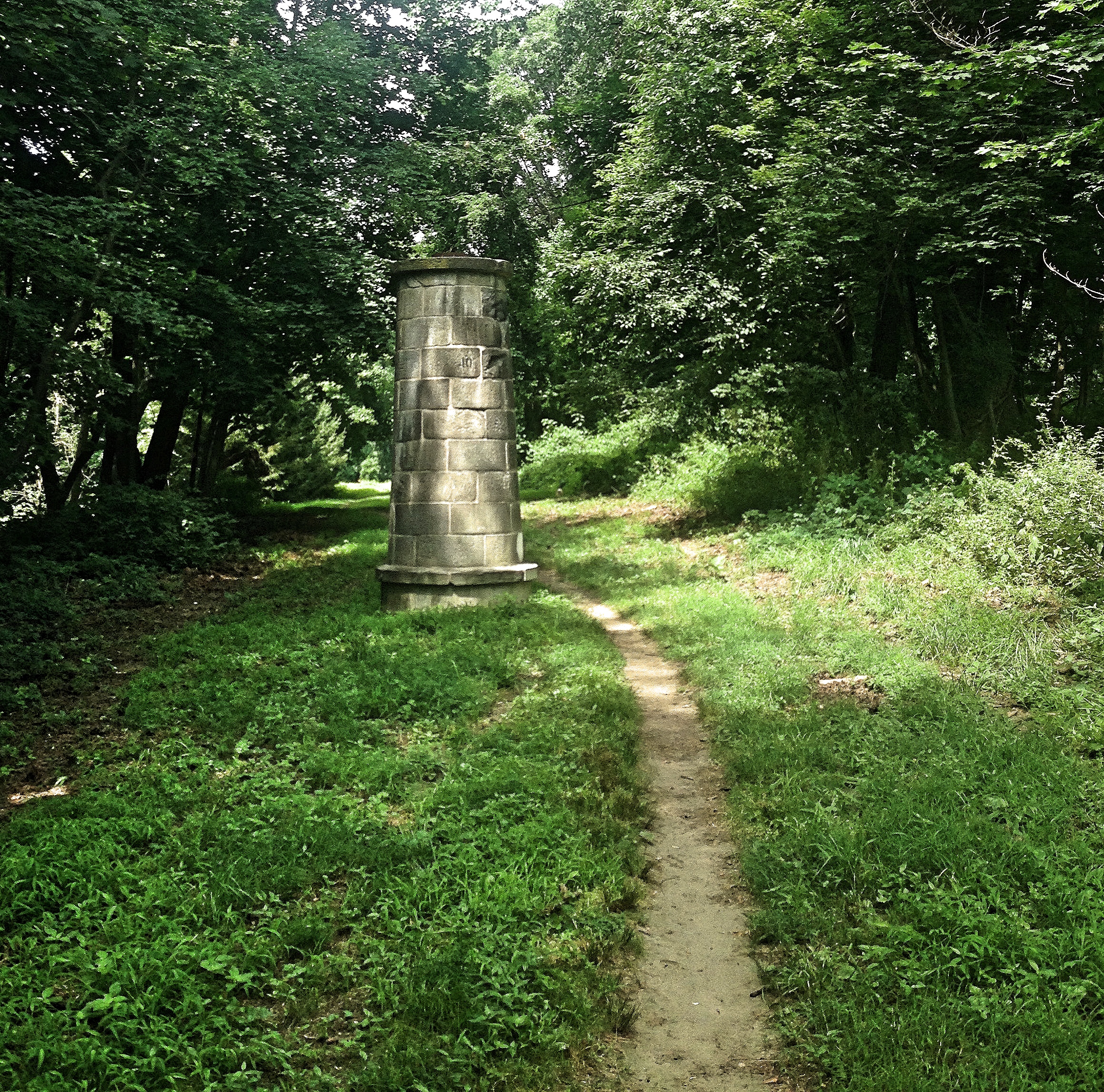
The walker will notice a few structures along the way. The most common are the ventilators, which are hollow stone cylinders with a shaft that allowed fresh air to reach the water below. These were installed to prevent pressure from building up inside the tunnel. Less frequent are the weirs, square stone buildings with metal sluice gates inside that could be dropped like a guillotine to divert the water in case repairs were needed. (And since the growing population of New York put heavy strain on the aqueduct, they frequently were.) These are situated above rivers, into which the water could be redirected. There is one above the Pocantico River in Sleepy Hollow, another in Ossining over the Sing Sing Kill, and another in the Bronx over the Harlem River.

In Dobbs Ferry stands one of the old Keeper’s Houses, where the aqueduct’s superintendents used to stay. There used to be six of these along the aqueduct, but the one in Dobbs Ferry is the only one that still stands. It is an inconspicuous white house now, but not long ago it lay completely in ruins; the restoration was just completed in 2016, by the combined efforts of the Friends of the Old Croton Aqueduct, a non-profit volunteer organization dedicated to the aqueduct, and the State of New York. This house is open on weekends and is well worth a visit. It contains many exhibits about the aqueduct, with historical photos, engineering drawings, and maps, and also has several short documentaries you can watch.

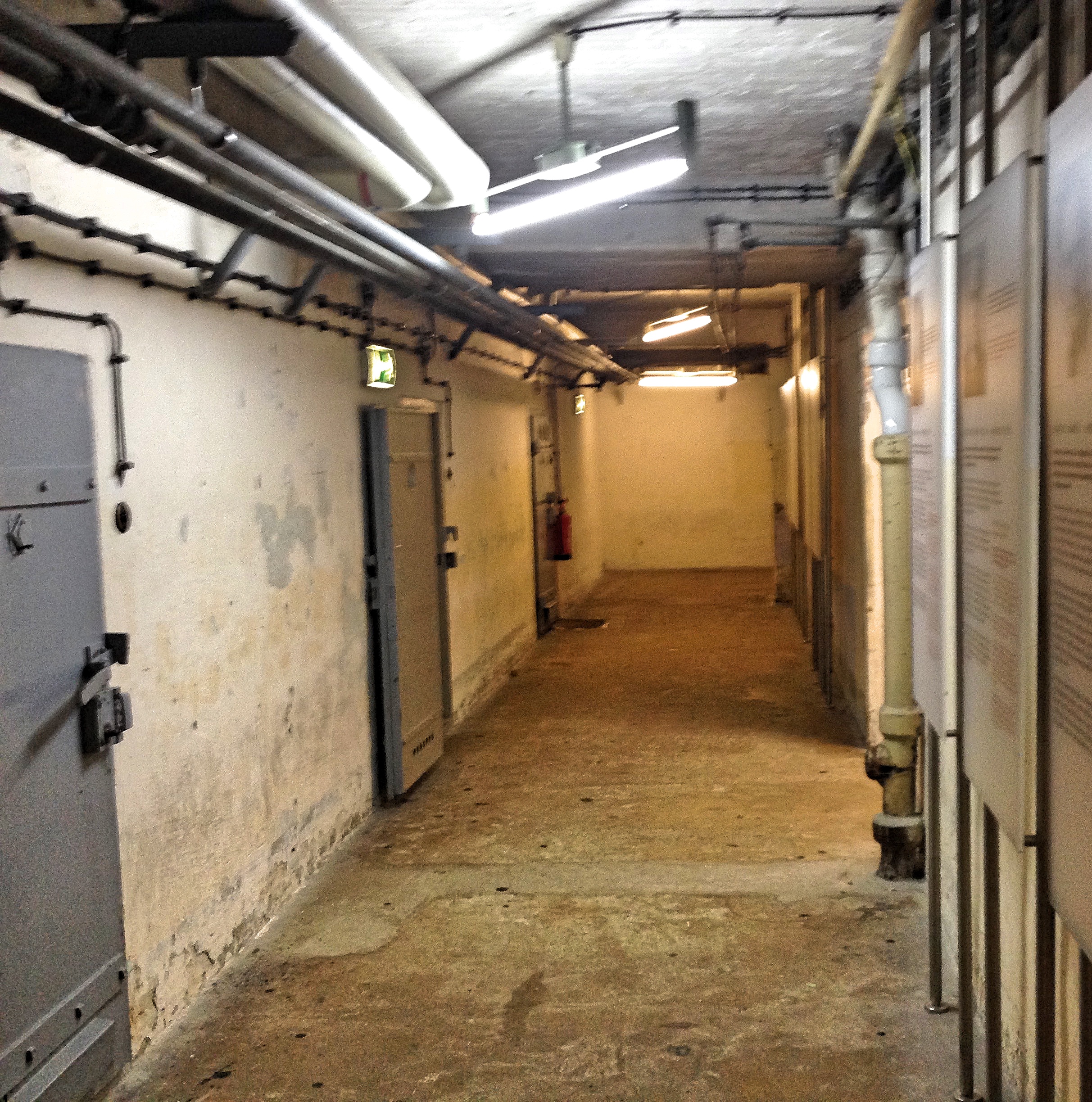
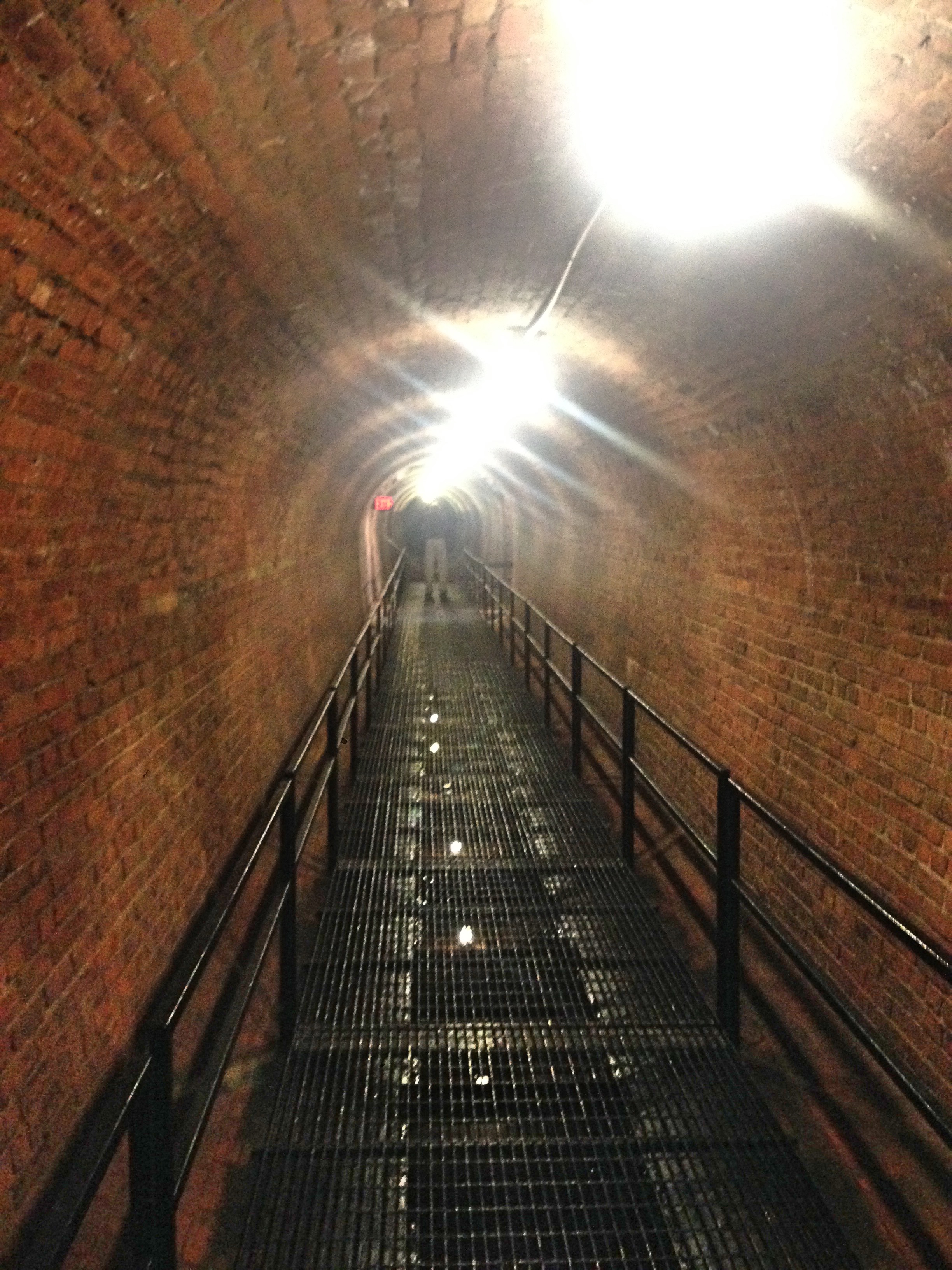
Up north in Ossining there is a stone bridge that carries the aqueduct over the Sing Sing Kill. (“Kill” comes from a Dutch word, meaning “river,” and is used in several place-names in New York.) A few times a year, The Friends of the Old Croton Aqueduct give free guided tours that actually bring you inside this bridge. I recently went on one, and I recommend the experience. A group of about two dozen visitors descended through the weir into the aqueduct. The old sluice gate is a rusty mass of metal now. But the aqueduct tunnel itself, made of brick and waterproof concrete, has held up remarkably well. The only marks of wear are some cracks in the walls from running the aqueduct at full capacity. It made me giddy to think that I could walk through that dark and dank tunnel all the way to New York City.
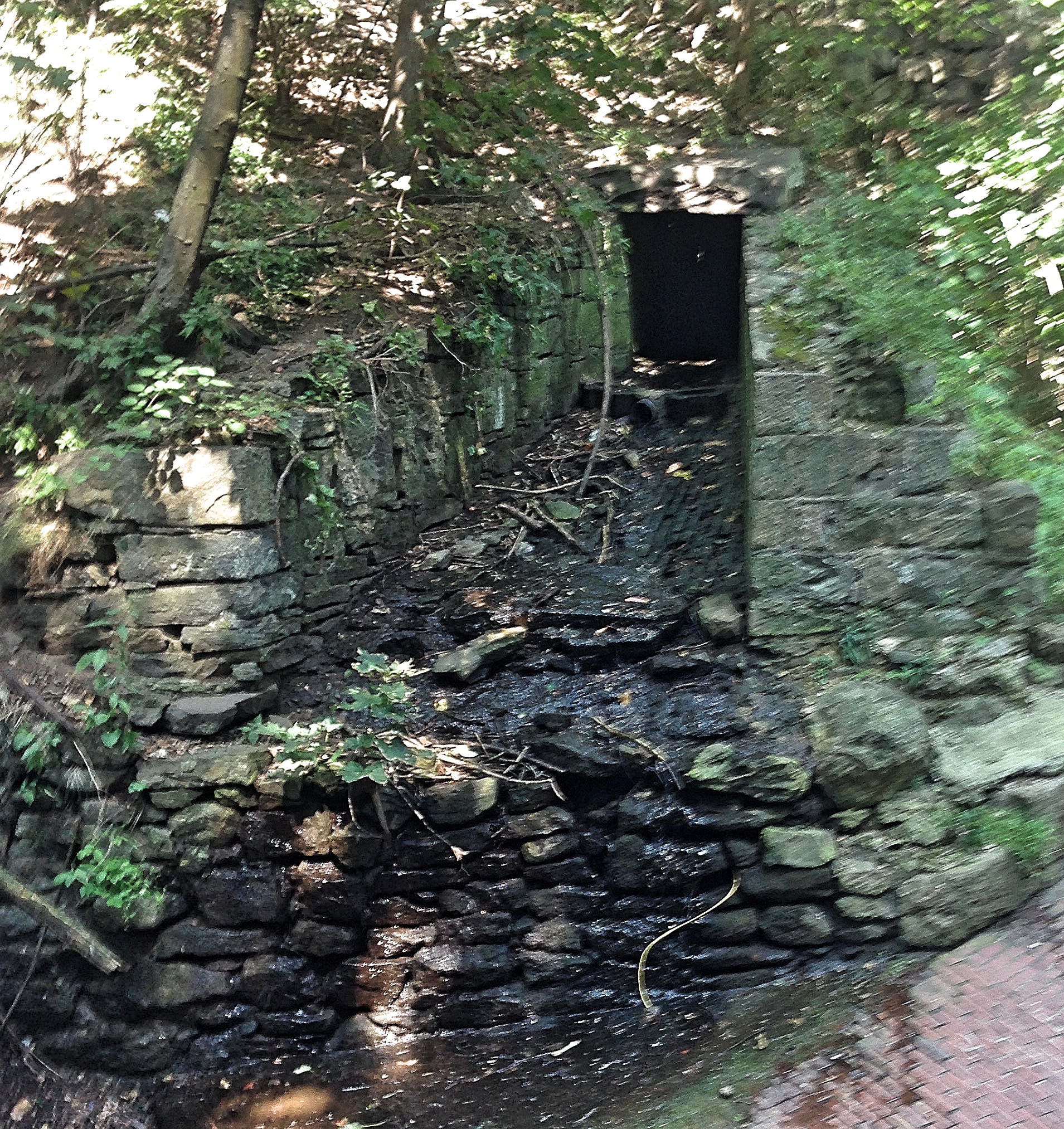
Below this bridge, there is an elevated walkway (a “greenway”) where you can stroll alongside the Sing Sing Kill. This was just opened last year, in 2016, and is astonishingly lovely. From this you can see the spillway, which brought the water from the aqueduct into the river during repairs. As the guide noted, the water would spray out with such force that it scoured the bank on the other side of the river.
From the information available in the Keeper’s House and the Ossining Visitor Center—from permanent exhibitions and documentaries on display—I pieced together the history of this great work. The original aqueduct and dam were commissioned in the 1830s after it became apparent that New York badly needed more water. Outbreaks of yellow fever and cholera killed thousands; and the Great Fire of 1835 destroyed hundreds of buildings, largely because the fire department lacked the water to put it out. Manhattan is an island of marshy ground surrounded by brackish water, and before the Croton Aqueduct was built the only water supplies were local wells which could be easily polluted.

The man primarily responsible for planning and engineering the original aqueduct was John B. Jervis, who must be one of the great engineers of 19th century America. He had political as well as engineering challenges to surmount. The land needed for the tunnel cut through hundreds of properties, mostly farms, each of which required an individual settlement. Meanwhile, the two political parties of the time, the Whigs and the Democrats, were squabbling over funding. Upon completion of the project, Jervis rode in a rowboat through the tunnel all the way from Croton to New York. I don’t know how long it took him, but it takes the water 22 hours to make the journey. This slow speed was intentional, by the way, since it minimized wear on the tunnel.
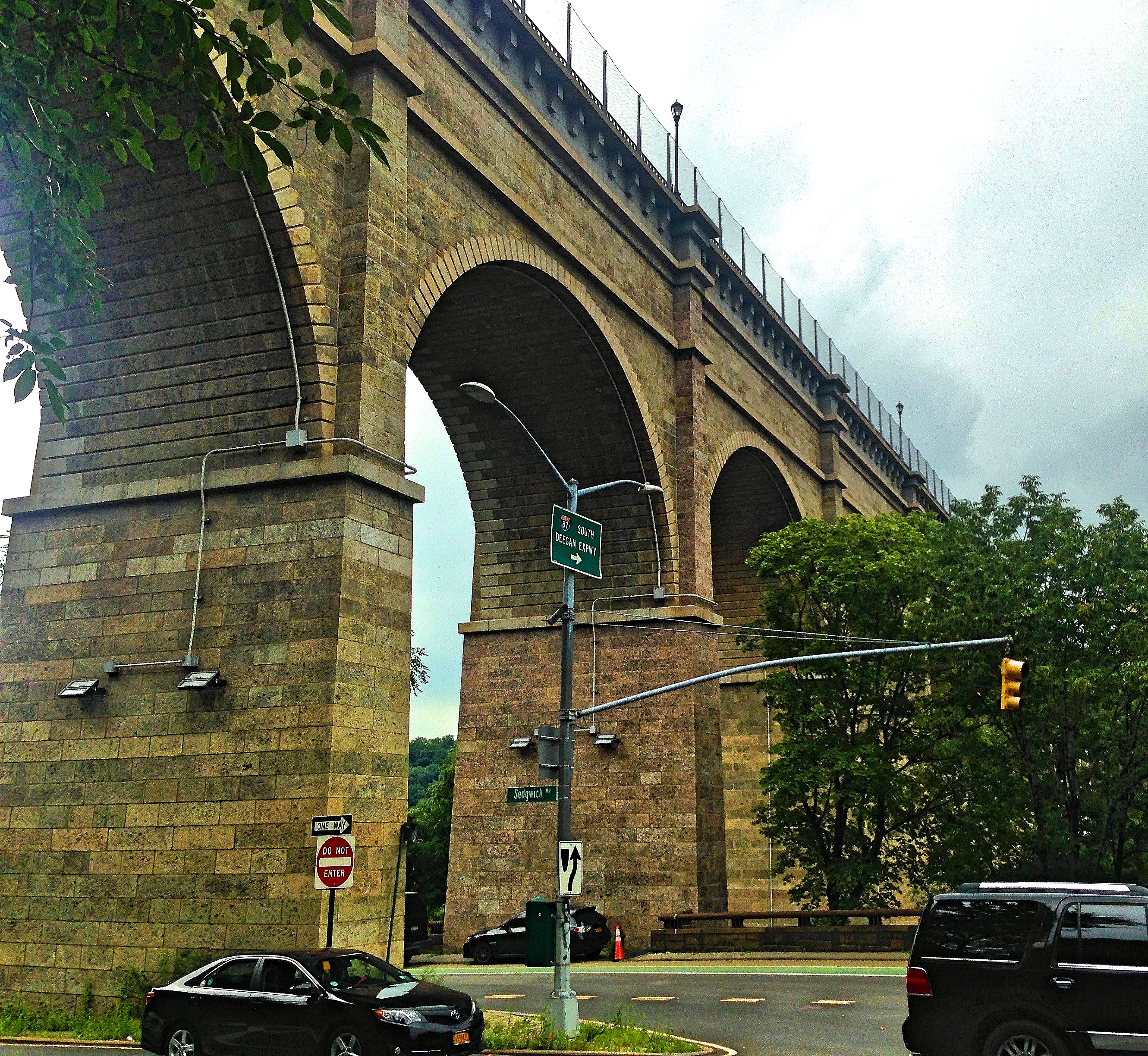
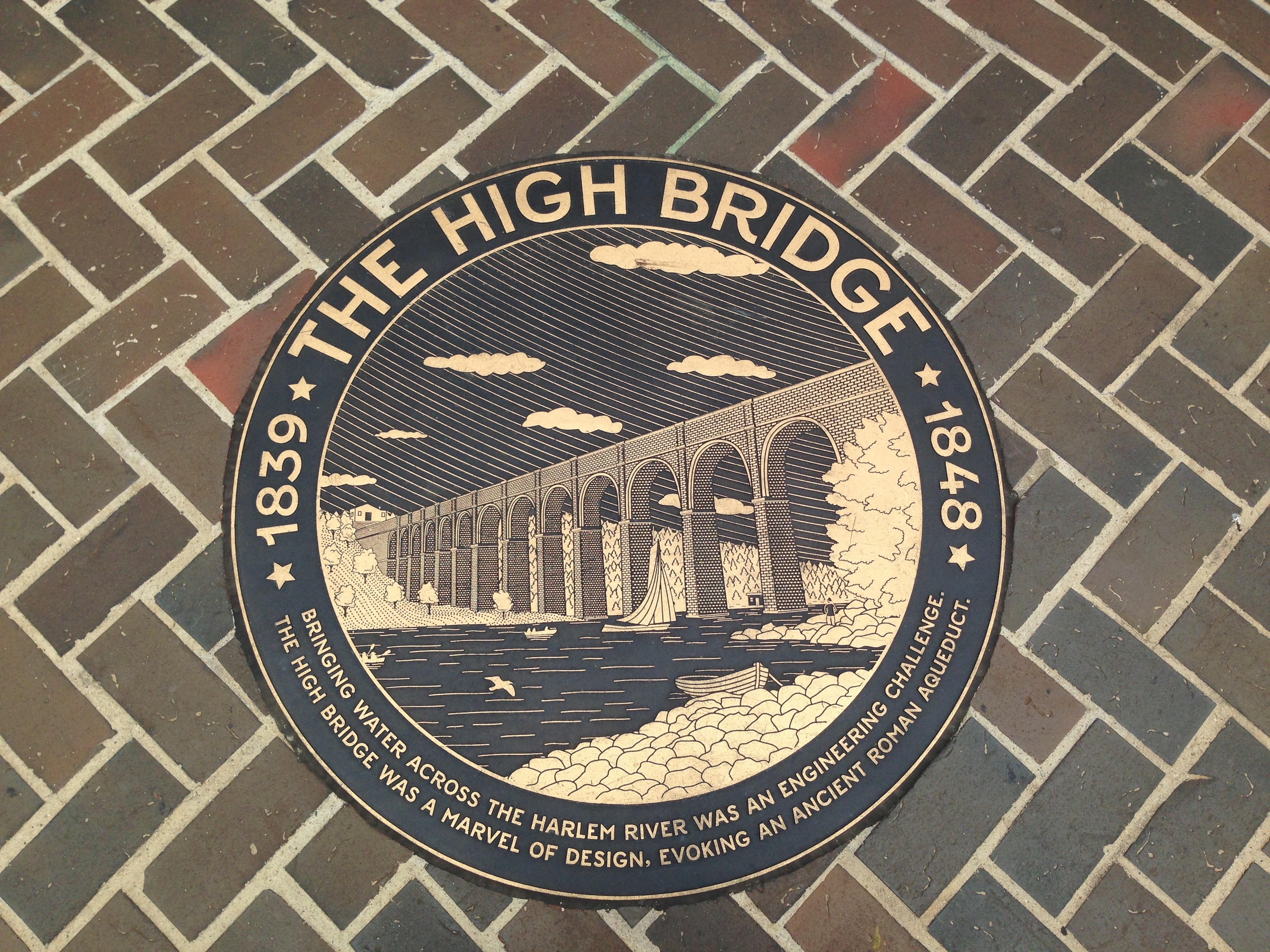
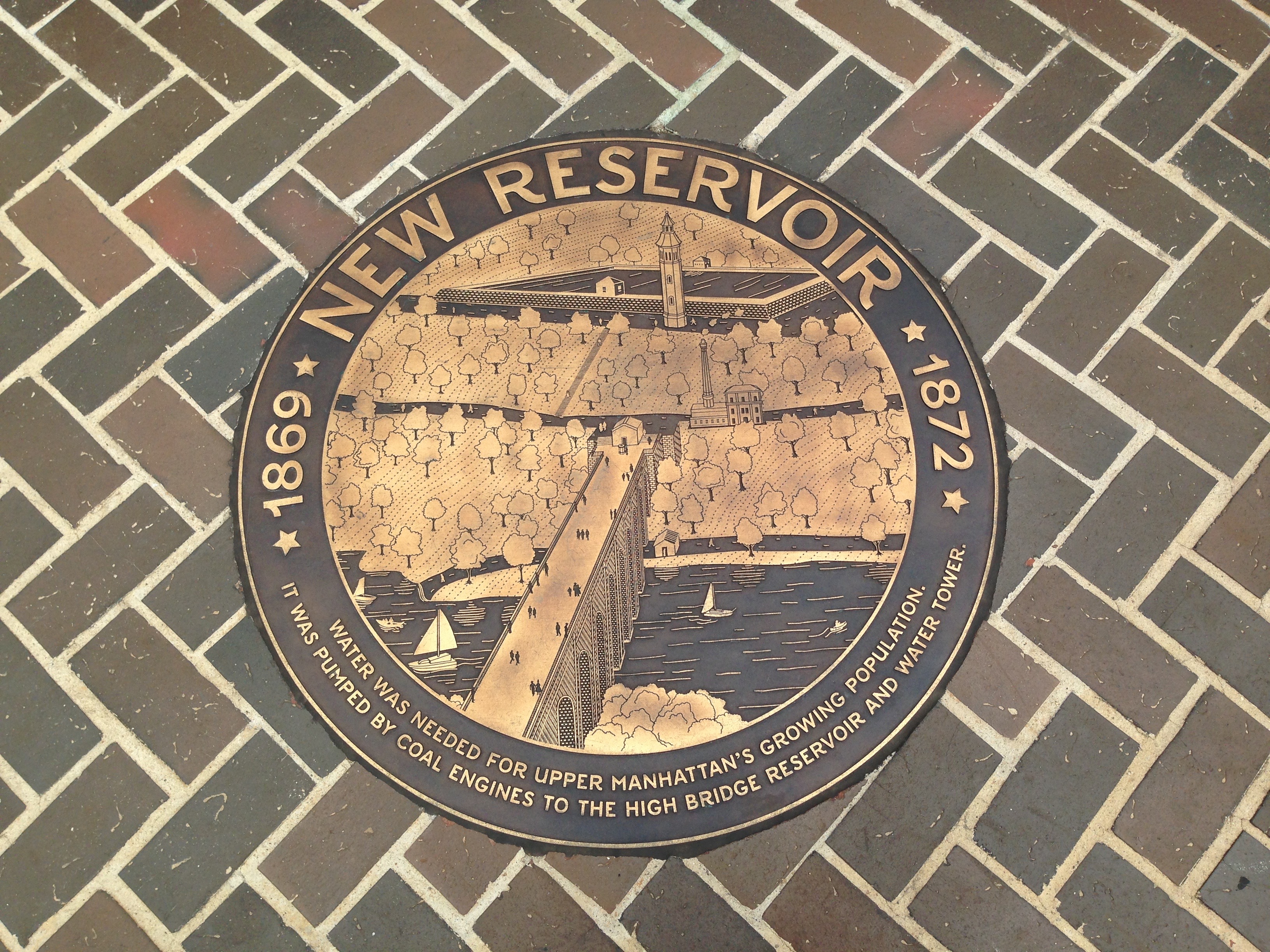
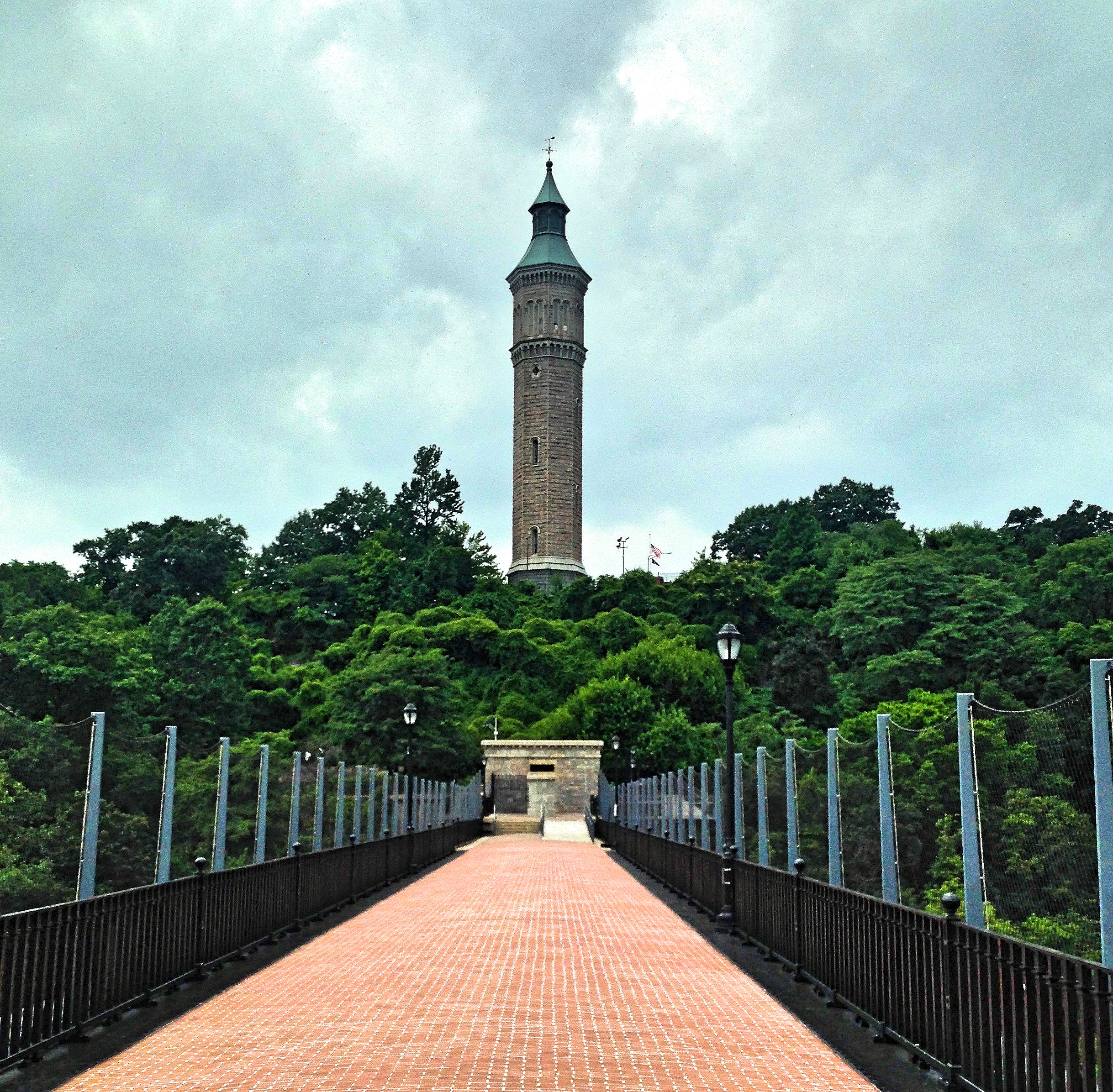
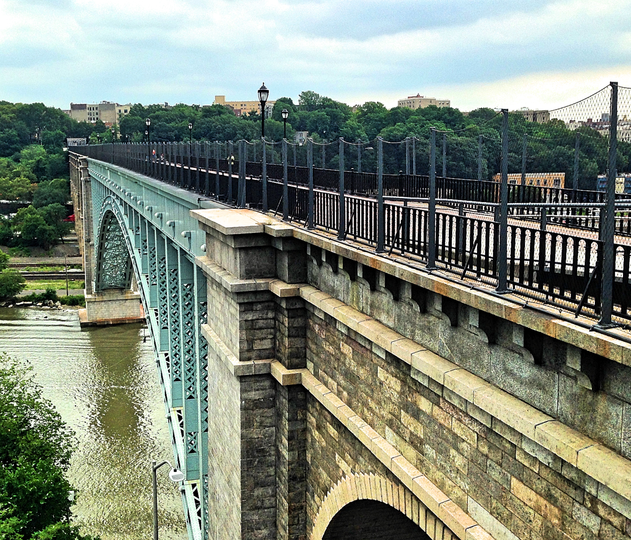
The largest structure of the original aqueduct stands on the southern end. This is the High Bridge. Opened in 1848, this is the oldest bridge still standing in New York City. It originally resembled a Roman aqueduct, with tall stone arches carrying the water high overhead, just like the famous aqueduct in Segovia. Indeed, one remarkable thing about the Croton Aqueduct is that it uses the same principle the Romans used all those centuries ago—namely, gravity—transporting the water on its 40 mile trip with a slight incline, 13 inches per mile. The bridge had to be built so high (140 feet) to maintain this slope. The water tower Jervis designed still stands on the Manhattan side of the High Bridge, looking like the turret of some bygone castle. (This tower was needed to pump water to some areas in the Bronx, which lay above the Aqueduct’s slope.)
In the 1920s people began to complain that the bridge’s arches were an obstacle to ships traveling through the river, so the middle stone pillars were demolished and replaced with a long steel arch. The bridge was officially closed to the public in 1970, apparently because of vandalism, and wasn’t opened until 2015—an astonishingly long time, if you ask me. (There are some excellent panels on the High Bridge, with illustrations of its history. I have attached the images at the end.)
As you can see from the High Bridge, the scale of the Old Croton Aqueduct is undeniably impressive: stretching about four times longer than the Aqua Appia in Rome (although, to be fair, I think the Romans built several aqueducts longer than the Croton Aqueduct), and requiring whole landscapes to be reshaped. The aqueduct was constructed by 4,000 laborers, mostly Irish, who made a dollar or less for ten-hour days. Having thousands of single men, with plenty of drink available (enterprising farmers began converting their barns into bars), predictably caused some ruckus. But it was a good job for the recent immigrants.
The opening of the aqueduct was something of a sensation. At the time, the Croton Aqueduct was one of the biggest engineering projects in the United States, only surpassed by the Eerie Canal. And the effect of the aqueduct on city life was scarcely less important than the canal’s. With a reliable source of clean water, the city began to expand at a remarkable rate. The original aqueduct was built with a maximum capacity of 60 million gallons a day. The engineers thought this would be enough water to supply the city for hundreds of years. But it wasn’t long until the ever-growing population of New York outstripped the capacity of the aqueduct. Indeed, it was largely thanks to the increased supply of fresh water that the city was able to grow so quickly.
Thus the aqueduct, designed to be used for centuries, was supplemented in 1890 by the New Croton Aqueduct, a larger tunnel that runs parallel to the old one. The Old Aqueduct stopped delivering water to the city in the 1950s. The New Croton Aqueduct is still in use—although it, too, has since been supplanted. The Croton watershed now delivers about 10% of NYC water. The majority of the water comes from the Catskill Watershed further north, ferried to the city by the Catskill and the Delaware Aqueducts. This latter tunnel, by the way, is the longest tunnel anywhere on earth, stretching 85 miles. New York is a thirsty city. (The current daily water supply of NYC is 1.3 billion gallons.)
Not only the original aqueduct, but the original Croton Dam was also replaced in the late nineteenth century. Jervis designed the original dam with an innovative S-shaped spillway to reduce damage from floods. But good luck seeing it now. Today, Jervis’s dam is underwater, submerged under the expanded Croton Reservoir, only visible in times of severe drought.
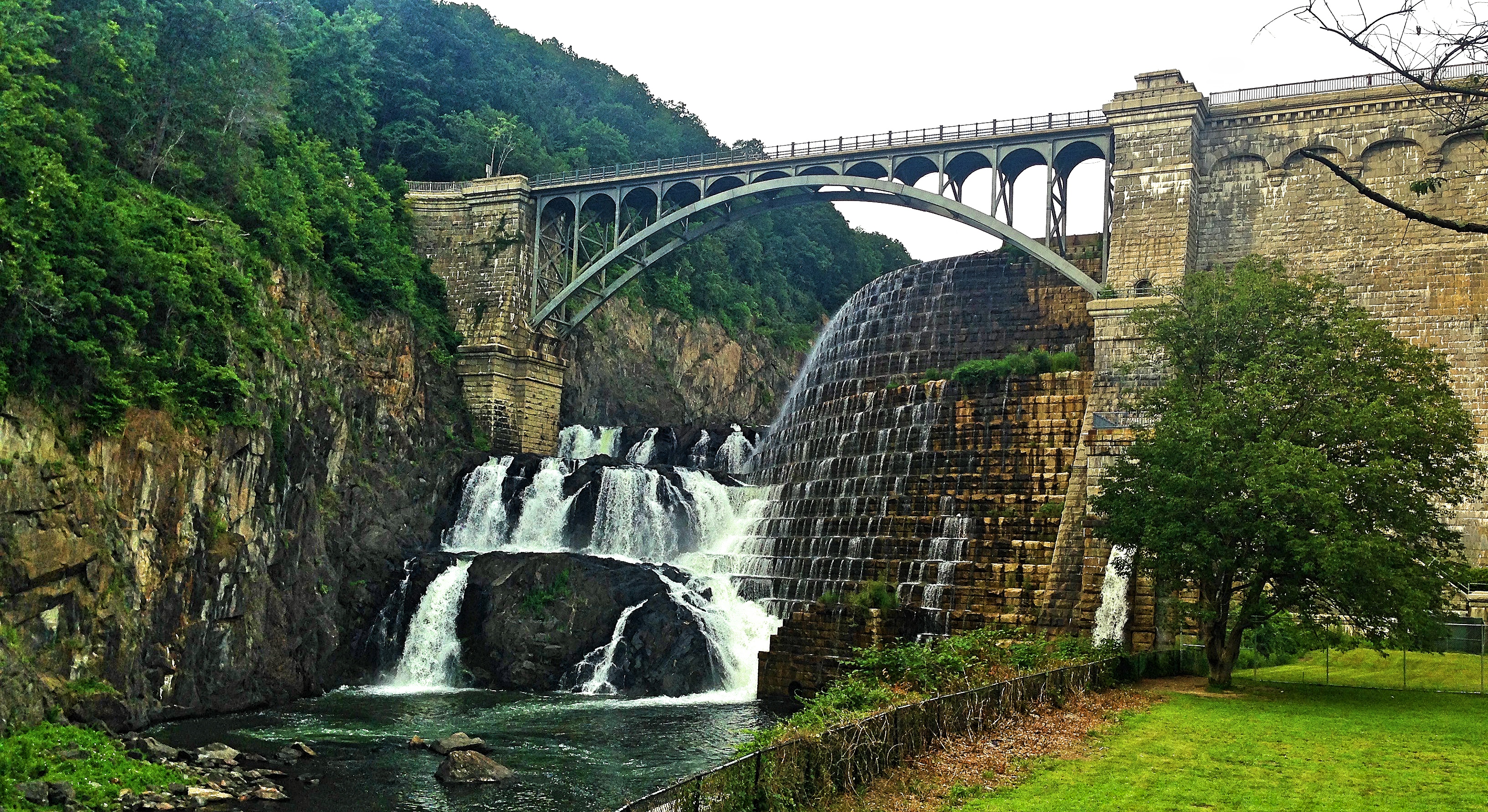
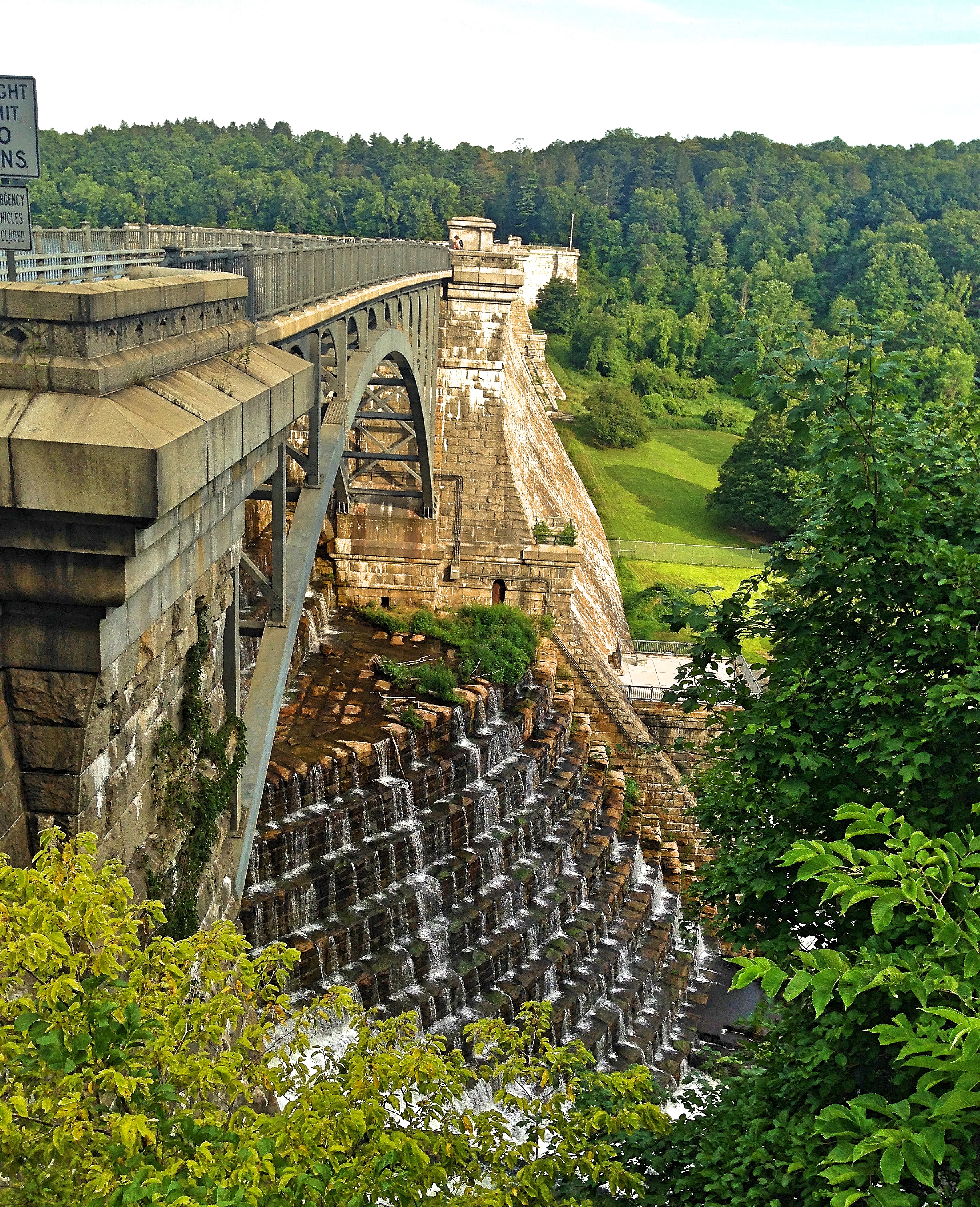
For my part, I don’t regret this loss, since that dam was replaced by the New Croton Dam—a grand monument of the previous century. Made of cyclopean stones, standing at almost 300 feet tall, and stretching to 2,188 feet (almost the exact altitude of Madrid, coincidently) the dam is still immensely impressive. It is also beautiful, with the stair-like spillway allowing water to cascade down to the river below in an artificial waterfall. This dam was begun in 1892 and completed in 1906. Whole communities—cemeteries, churches, and farms—had to be moved to make way for the expanding reservoir. Standing on top of that dam, hearing the rushing water below you, does a better job than any statistic of conveying how much water a major city like New York needs.
As part of my research, I also read the book in the Images of America series about the construction of the New Croton Dam. The story of this construction is told with dozens of old photographs, with commentary by Christopher Tompkins. You don’t exactly get a linear narrative this way; but the images alone are worth the price. It baffles the mind to think of what these men accomplished—redirecting a river, and erecting a structure 300 feet tall with cut stones, flooding an entire valley and displacing many communities—and all this using technology that looks, to my eyes, scarcely more advanced than what the Egyptians used. That’s an exaggeration, of course: the dam workers had steam shovels to excavate and railroads to bring stone from the quarry. But I can’t imagine how difficult it would have been to move those massive stones in a time before modern cranes, using only wooden derricks and pulleys and counterweights.
It is amazing to me that so much history—an engineering feat and a chapter in the history of New York—lay buried right behind my house, and that I’ve been walking along this trail for so many years, oblivious. Don’t wait until you travel to learn about history, to explore and go on tours. Take Thoreau’s advice: “Live at home like a traveler.”
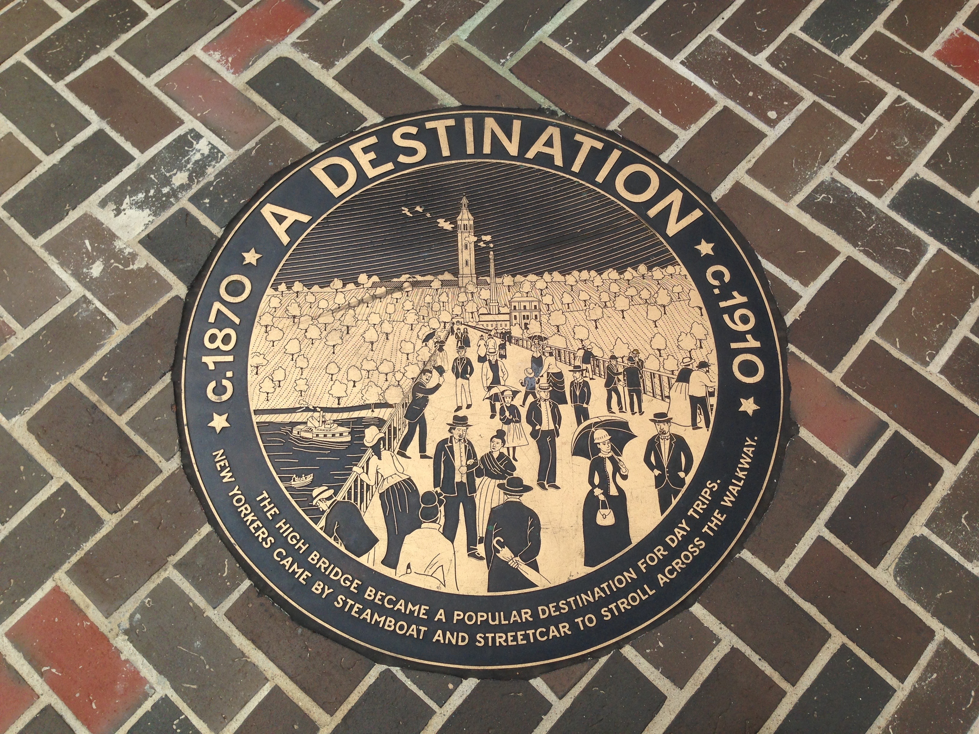
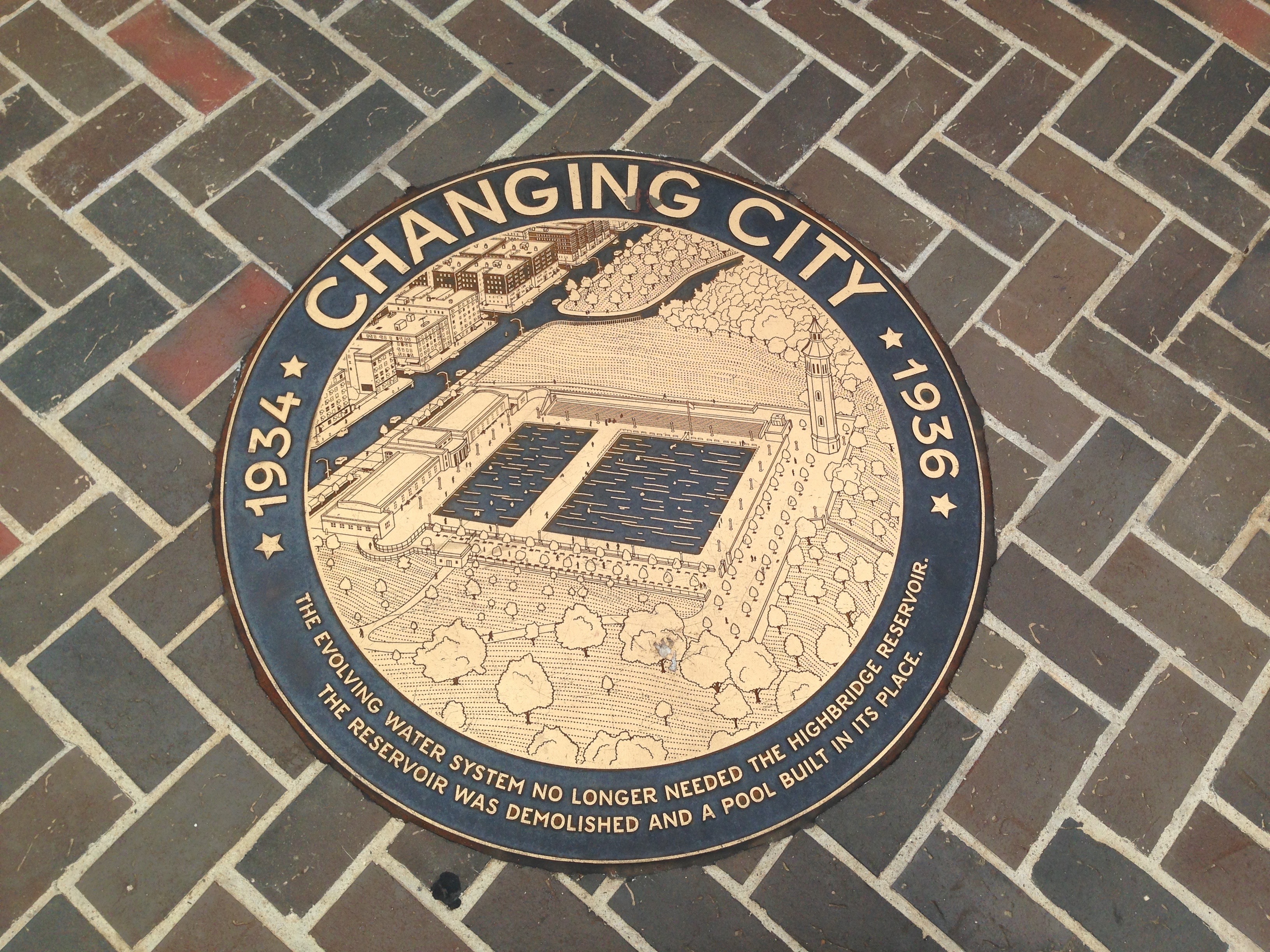
These images are taken from informational panels on the High Bridge.