Dresden: Out of the Flames

Dresden: Out of the Flames

After Spain, the country that I got to know best during my time in Europe was Germany. This was, in part, because I was studying the language. But I also came to love Germany because, in some ways, it reminded me of home. Perhaps it was the climate (very similar to New York), or perhaps it was the modern style of architecture, or perhaps it was certain aspects of the culture—more reserved and pragmatic than Spaniards. For whatever reason, I felt very much at home whenever I was in the country, which is why I visited at least once a year.

Yet I was not feeling particularly good on a bright May morning in 2024, as I set foot in Dresden. After enduring a very early flight, a layover in Munich, and then another cramped airplane seat, I felt sleep-deprived and dehydrated. More than that, I realized—with horror—that I was getting sick. But I was not going to let any physical ailment impede my vacation. Resolutely, I dropped off my bags and marched off to the center of Dresden.

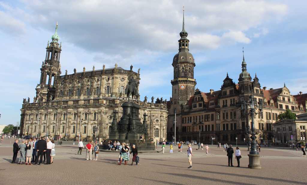
Dresden presents itself to the visitor as a landscape of royalty, where stately buildings tower over cobblestone streets. In many ways, it reminded me of Vienna—a place where “high” culture (opera, theater, ballet, the fine arts, and so on) went hand in glove with the ruling class. And the architecture of the old town—refined, ornate, stately—makes this exceptionally clear. Of course, what the modern viewer sees today is a kind of illusion. Virtually every building has been rebuilt since the Second World War. But it is a very convincing illusion.

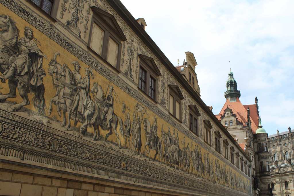
Though Dresden has not been an important center of power in modern times, historically it has served as the seat of the Saxon kings, who ruled over this part of Germany (as well as Poland, for a time). To get an idea of this long and distinguished  history, the visitor can do no better than to visit the Fürstenzug (or the Procession of Princes). This is a massive porcelain mural—the largest in the world—that depicts all of the heads of the ruling house of Wettin for nearly one thousand years. Stretching over 100 meters (or over 330 feet) on the Augustusstraße, the mural depicts 35 rulers chronologically from left to right—and gives the viewer a visual representation of Saxony’s long and rich history.

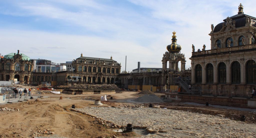
As a mark of royal power, Dresden has historically been a center of the fine arts. This was illustrated by my first visit, to the Gemäldegalerie Alte Meister (The Old Master’s Picture Gallery). This is exactly what it sounds like. And it is housed in an appropriately ornate edifice—indeed, a literal palace. This is the Zwinger, one of the most important baroque buildings in Germany. Admittedly, what stands today is a reconstruction of what was destroyed during the Allied bombing; and when I was visiting, some of the inner courtyards were undergoing heavy restoration. Still, from the exterior the building maintains an impressive grandiosity, especially seen from the other side of its watery moat.

The palace under restoration.

After climbing up the monumental stairway, I found myself surrounded by room after room of masterful paintings. It never ceased to amaze me how even lesser-known cities (nobody I know has been to Dresden, for example) can have first-rate museums. As a case in point, here you can find works by Rembrandt, Titian, and Vermeer. 

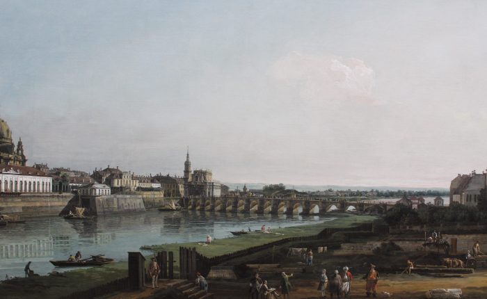
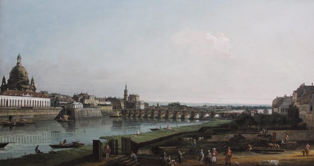
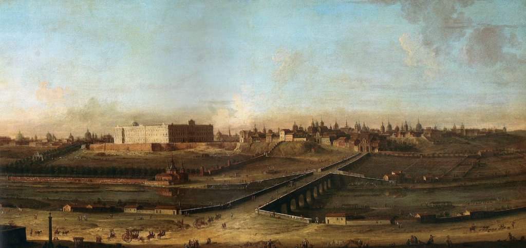
I was particularly interested in the monumental paintings of Bernardo Bellotto. This Italian artist was the nephew of the famous Canaletto—who made such iconic images of Venice—and followed in his uncle’s footsteps with his own careful renderings of cityscapes. Indeed, Bellotto’s paintings of Dresden have an added historical importance, as (notoriously) the old city was almost entirely destroyed by Allied firebombing in the Second World War. But more on that later.

A view of Dresden and the Elbe. Notice the Frauenkirche on the left.

The most famous piece in the museum’s collection is, without a doubt, Raphael’s Sistine Madonna. It is classic Raphael—perfectly graceful, harmonious, and beautiful. But like many viewers, I find the “putti” (the little angels) at the bottom to be the most charming part of the composition. They are so very human—with expressions mixed with curiosity and boredom, so discordant in the triumphant heavenly scene above. One wonders what Raphael, a pious man, was thinking when he painted them.

My ticket to the Gemäldegalerie Alte Meister also included an entrance to the Mathematisch-Physikalischer Salon (yes, the Germans are snappy with names). This is in another wing of the Zwinger palace, and it is a museum devoted, not to art, but to science. I do tend to think that the history of science is unduly neglected in wider culture. We tend to encounter science as a finished product, with all the trappings of modern technology. But in the days before science was so strictly divided from the humanities, it was more approachable and, arguably, a more aesthetically sensitive venture.

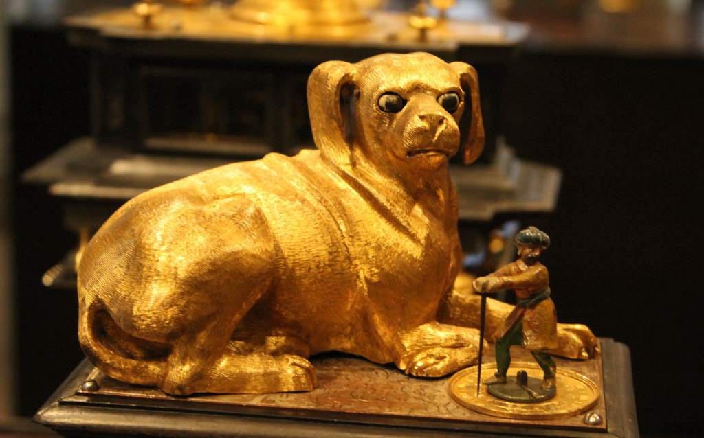
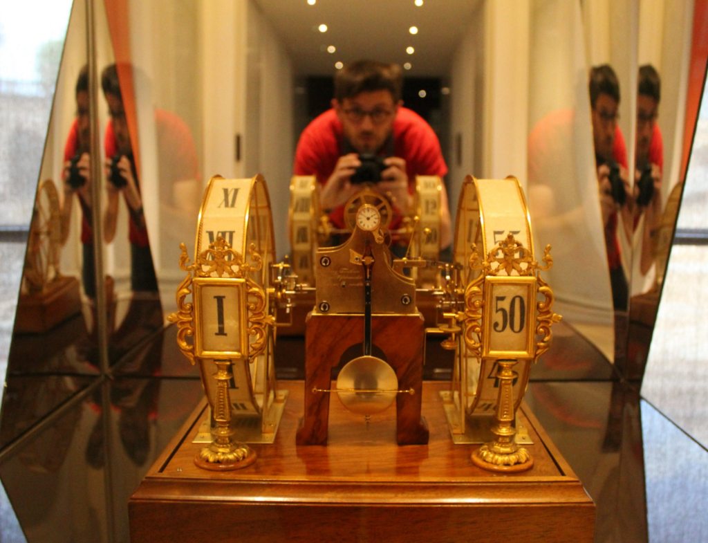
A very whimsical clock.

This scientific salon goes back to the early 18th century, and has been housed in this palace since 1728. The collection consists of historical—and quite beautiful—scientific instruments, divided into four categories: mathematical devices, clocks & automatons, telescopes, and globes. Every section is full of wonders. The calculating devices (which use mechanical means to do complex operations) are the forerunners of computers, while the automatons—such as a bear that plays the drums—are the first attempts at robots. Both the globes (made before much of the earth was mapped) and the telescopes are evidence of what may be our species’s finest quality: curiosity. 

I did my best to feel wonder and awe as I gazed at these artifacts of human genius. But I was really feeling sick by now, and it is hard to be moved in such a state. So I walked back to the Airbnb, ate an early dinner of Vietnamese pho—absolutely the right choice—and went right to bed. Nothing, not even a microbe, was going to ruin this vacation.


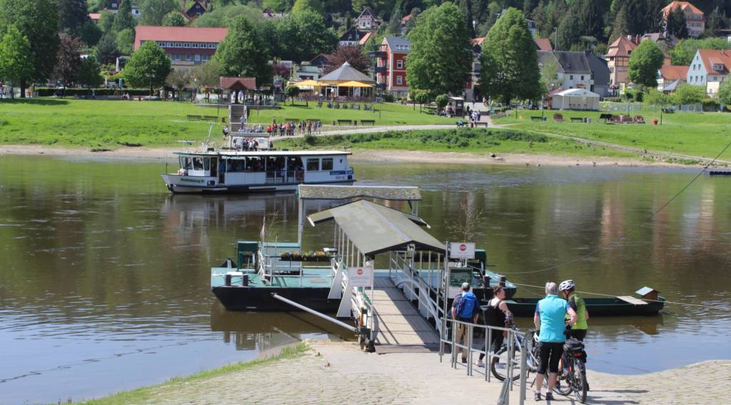
The next morning, after over 10 hours of sleep, I woke up feeling fit as a fiddle. To celebrate, I decided to see a little nature. After a trip on the S-Bahn line one, I got off in a little town called Kurort Rathen. From there, I caught the ferry that crosses the Elbe River. There, it was a short distance to the Sächsische-Schweiz national park.

The name translates to Saxon Switzerland, as the Germans—whose country is quite flat in the north—have a tendency to call any hilly area “Switzerland.” In truth, the rocky mounds that I encountered here had little resemblance to the snow-covered alps. Still, it was a beautiful May day and the forest was green and inviting.

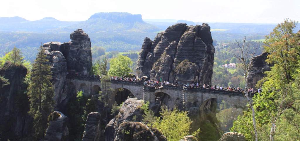
I climbed up a path, navigating hordes of picnicking Germans and busloads of all sorts of tourists—Chinese, American, French—to eventually get to the main attraction: the Basteibrücke. This is a monumental sandstone bridge that connects the several peaks of the Bastei, which is an otherworldly assortment of stone spindles, formed over millennia of erosion. Even amid the crowd, the strangeness of these rock formations was absorbing.

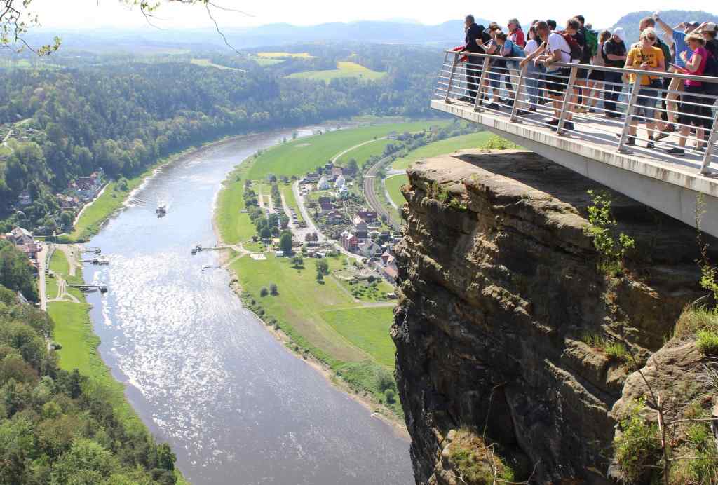
Further on, I reached a rest area with a food stand and a viewpoint, where I could eat a sausage while I contemplated the Elbe valley. The countryside was almost pastoral, and reminded me very much of the Rhine Valley in the far corner of the country. “Is this just what Germany is like?” I wondered. A tall German beer aided my ruminations; and that, after some mulling about, I was barreling down the hill back towards the ferry.

However brief, this dip into the forest was refreshing. Madrid, though beautiful in so many ways, is never lush or woodsy in the way that I crave. Once again, Germany managed to remind me very strongly of the landscapes of the Hudson Valley, where I grew up. In other words, once more I felt strangely at home in this country.

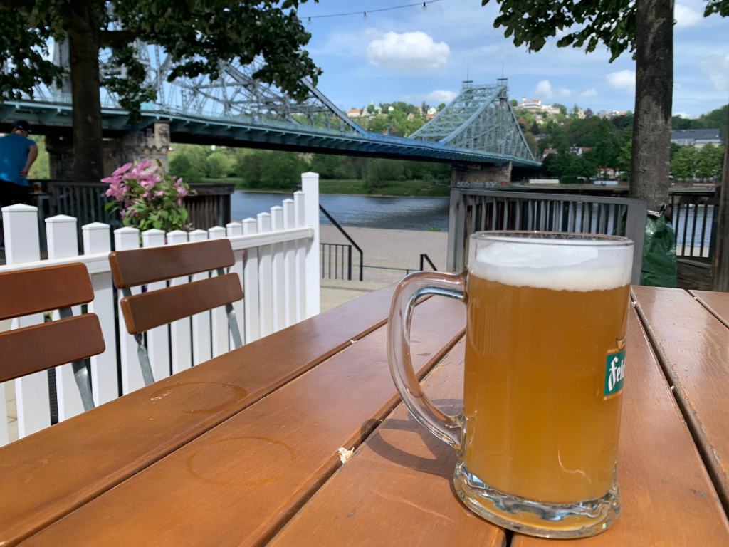
After a return trip on the ferry, I got back on the S-Bahn. But I did not take it all the way back to the center of Dresden. Rather, I got out early to visit another attraction along the Elbe: the Blaues Wunder. This is the pet name for the Loschwitz Bridge, a cantilever bridge connecting both sides of the river. Constructed in 1893, it was considered something of a technological marvel at the time (thus its name).

Nowadays, it is beloved more for being one of the few things that survived the destruction of the Second World War. Set to be blown up by the retreating SS, two ordinary citizens reportedly took it upon themselves to cut the detonation wires. I did not know that historical infrastructure could be so inspirational. In any case, as I stood on the bridge contemplating the river, I cannot say that I found it especially blue nor especially wondrous.

I was more taken with the SchillerGarten. This is a nearby Bier Garten, one of the best in the city. And this was the setting for my next beer/sausage combination—which I enjoyed as I idly watched the river flow by. As a side note, while it is not fine dining by any means, I have to admit that I always enjoy the fare at German restaurants. Simple and hearty, it pairs admirably with their beer—which is, of course, world-class. Indeed, in subsequent days I would spend quite a bit of time at other beer gardens overlooking the river, most notably the Augustgarten closer to the center. Nothing is more pleasant on a sunny day.

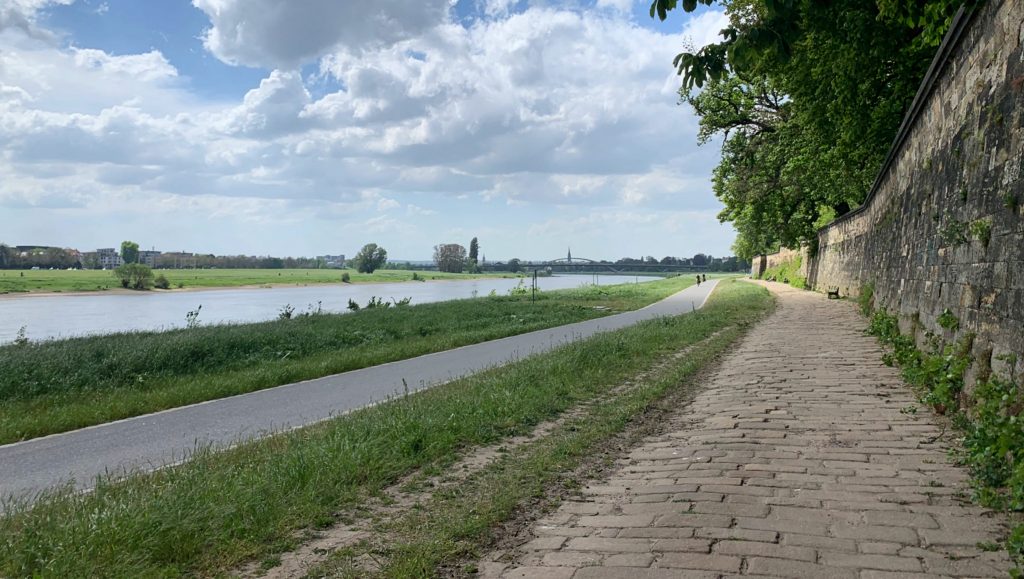
Needing to work off this meal, I decided to walk the rest of the way into the center of the city. This took me along a region of the Elbe Valley that was once considered a UNESCO World Heritage site. This designation—granted for its mixture of natural meadows and the many historical buildings alongside the river—was sadly revoked in 2009, as a result of the construction of the Waldschlösschen Bridge. Ironically, this bridge had to be built to relieve traffic on the aging and (by modern standards) narrow Blaues Wunder. History is rich in ironies.

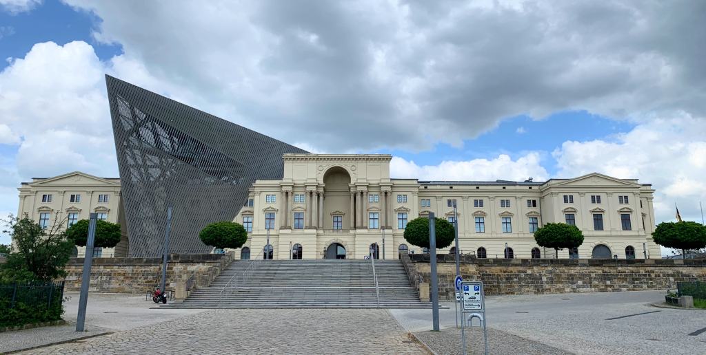
As I walked along the meadow, I hardly felt that I was going anywhere at all—so flat and green was the landscape around me. But I did not follow the course of the river until the familiar profile of the historic city center came into view. Instead, I turned north, walking through the newer part of the city, until I reached a strange building that looked like it had been pierced with a sharp object. This was the Bundeswehr Military History Museum.

The building has a telling history. Beginning its life as an armory in 1876, it has since served as a museum for the Nazis, the Soviets, as well as East Germany. Closed during reunification, it was eventually decided to re-open the museum, but with an important redesign. This is the aforementioned sharp object—a transparent arrowhead, designed by Daniel Libeskind, a Jewish architect—is meant to symbolize the museum’s new role in a democratic society.

Even so, the idea of visiting a military history museum in Germany of all places may not seem especially appealing. But this one has taken pains to distance itself from traditional military museums, which are often a celebration of the machines of war. Rather, here the visitor can walk through exhibits that explore war from a variety of angles—not just technological or strategic, but also political, social, and historical. There is even an exhibit on the use of animals in war.

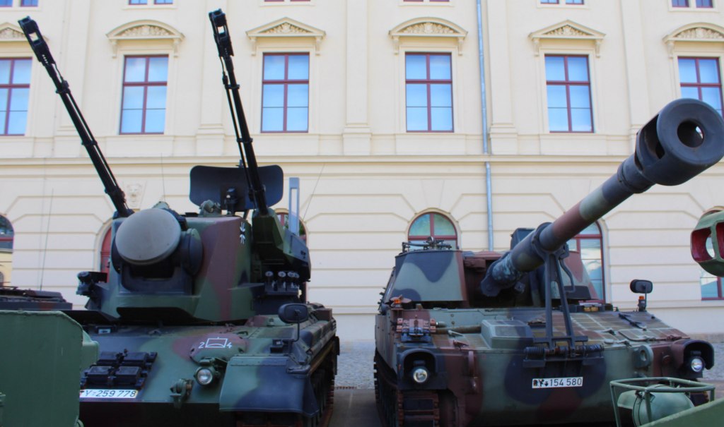
Indeed, the museum is gigantic, filling up the entire historical armory—and even stretching outside, where the visitor can see several military vehicles parked on the lawn. I should admit that, after the long walk along the river, I probably did not see all there was to see. And I must also admit that I have a limited ability to engage with military insignia, medallions, and uniforms (especially when there are thousands of them). But I was impressed at the massive and earnest attempt to see warfare in such a holistic way, as something humans have done for all of recorded history, without attempting to celebrate, condemn, or reduce it.

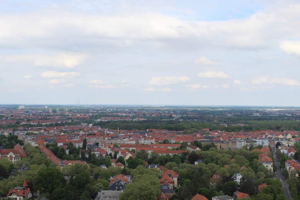
As a case in point, my visit culminated in the large transparent arrowhead that sticks out of the front of the building. This was designed to point to the area of Dresden where the firebombing began. Inside, apart from a commanding view of the surrounding neighborhood, you can see relics and ruins of the burnt-out city.

The 1945 fire-bombing of Dresden has become notorious in popular culture, in part thanks to Kurt Vonnegut’s classic novel Slaughterhouse-Five. (Vonnegut himself was a witness to the destruction, having been a prisoner of war in the city.) After Hiroshima and Nagasaki, Dresden is arguably the best-known example of Allied atrocity. In short, heavy bombing by British and American forces killed thousands of civilians and obliterated the city’s historical core—one of the finest in Europe.

This blog post is certainly no place to re-litigate this event—condemned, justified, polemicized, used in Nazi and Soviet propaganda, among much else. The museum itself presents the bare facts of the event, with little editorializing. I will only point out that, during the so-called “Good War,” which most people nowadays would say was justified—the Allied war against fascist world-domination—there were still actions that caused the leaders and believers in that fight to pause and recoil. But what makes a war justifiable? And can a justifiable war be won with unjustifiable means? These are not easy questions to answer, but they are worth pondering.

This was heavy stuff. And by now, I was both mentally and physically exhausted. So I decided that it was time for a kebab. The humble Turkish kebab has become a kind of pan-European fast food, available from Portugal to Poland. But the best ones, in my experience, are to be found in Germany—largely thanks to the sizable population of Turkish immigrants. And while the one that I had that day in Dresden (at the nearest shop I could find) wasn’t the best, it did revive my flagging spirits. And with a couple German beers, this capped off my second day in Dresden.


One of the best parts of my stay in Dresden was the neighborhood of the hotel: the so-called Neustadt. While this translates to “New City,” this is ironically the most authentically historical part of Dresden, as it largely escaped the Allied bombing.

New, of course, is a relative term; and what is new in Europe may be quite old. This neighborhood is called “new” because it was rebuilt after a 1732 fire. The neighborhood was rebuilt on a regular plan, giving it a more tidy and uniform appearance than many old European cities. Yet it retains an important collection of Baroque architecture.

But for locals, the Neustadt is more important for being a center of nightlife and counterculture. This is important in a city like Dresden, which in modern times is known as a conservative bastion (in part a reaction against the communist years of the DDR). The Neustadt has a punkish vibe, full of graffiti and dive bars. Each night, the streets were full of people—young and old—exercising their legal right to drink in public. A little metal shed for street urination is a nod to decency.

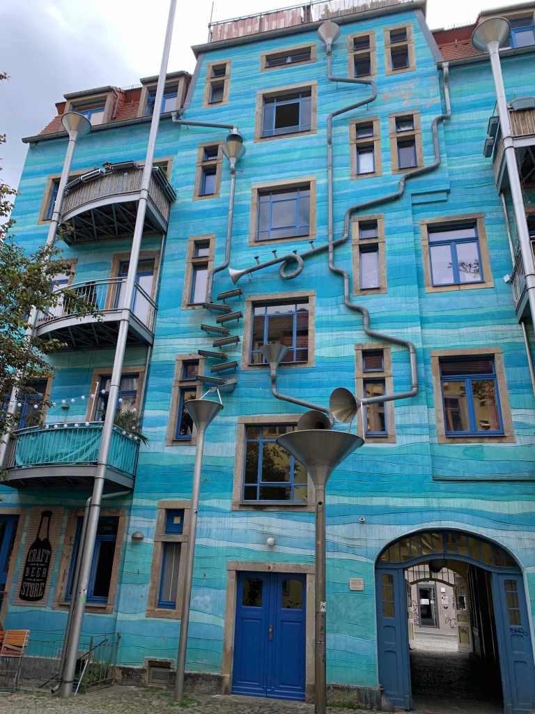
One of the most characteristic attractions in this part of town is the Kunsthof-Passage. This is a kind of inner courtyard, surrounded by whimsically-decorated apartment buildings. This is, in a way, the Neustadt counterpart to the historic city’s Fürstenzug—not a celebration of royal power, but of local artists. Dresden would be a dull city without this dichotomy.

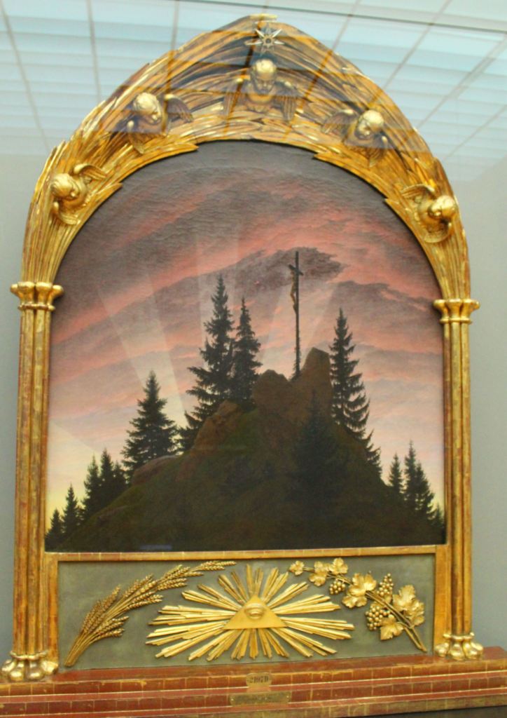
You can see a further illustration of this by visiting the Albertinum. This is the other major art gallery of Dresden, picking up where the Old Masters Gallery leaves off. Its collection of paintings is equally impressive, including works by Monet, Munch, and Van Gogh. However, I was more excited to see work by the German artist, Caspar David Friedrich. The quintessential romantic painter, he was unparalleled when it came to depicting the smallness of humanity when faced with the bleak power of nature.

Nothing illustrates this better than the Tetschen Altar. Painted in 1808, early in the painter’s career, the altar depicts the crucifixion from a far distance, as a silhouette at the top of a mountain. Rather than centering Christ’s suffering, therefore, the altar emphasizes its smallness amid the surrounding landscape. Needless to say, this proved to be a controversial choice.

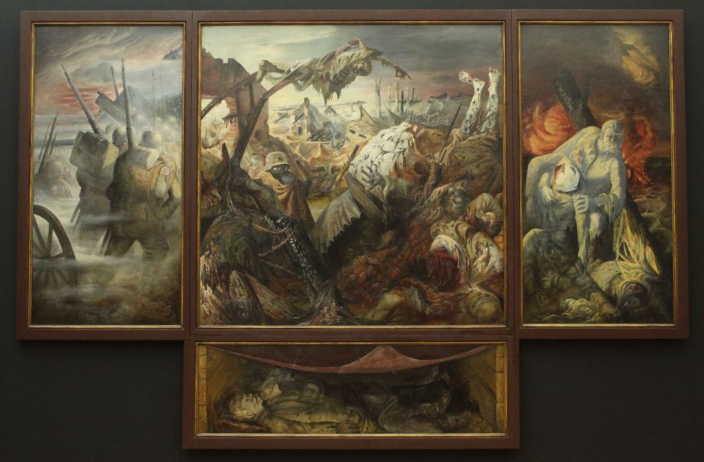
Another standout work is the Dresden Triptych, by Otto Dix. Himself a veteran of World War I, fighting for the German Army, he later became a prolific anti-war artist (which led his art to be condemned as “degenerate” by Hitler). This work, titled The War, is a prime example of his grim vision. Like Caspar David Friedrich, Dix here uses a religious format, but he does so ironically. War is here nothing but carnage and chaos—the furthest thing from the glorious struggle that leaders have so often claimed it to be.

Indeed, the collection of this museum is marked by war in several respects, as 196 paintings were destroyed during the firebombing. War and art are, so often, opposing poles in human history.

The Albertinum is also the home of the city’s excellent collection of sculptures. This is immediately apparent when you walk into the museum, as there is a room jam-packed with plaster casts of famous statues, including a full-sized replica of Michelangelo’s David (which, when I visited, was holding a Ukrainian flag). The museum’s collection ranges from antique Greco-Roman sculptures—some of them quite excellent—to modern works, by Degas or Rodin.

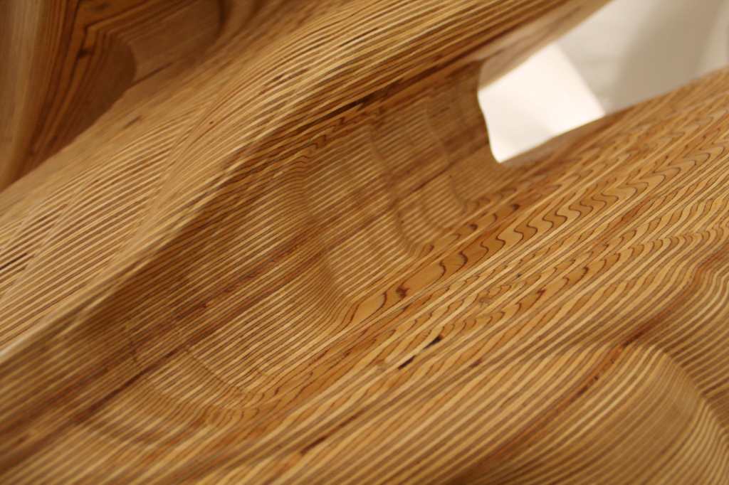
Yet for me, the highlight of this collection was the contemporary gallery. Housed in an expansive room on the lower level, these statues ranged from hyperrealistic portrayals of the human body to geometrically arranged heaps of junk. Indeed, although I cannot say I am normally a huge fan of the avant-garde, I found these works to be more exciting than still another white marble statue. My personal favorite was a work by Tony Cragg—a huge piece of wood that has been carved into an amorphous, otherworldly undulation.

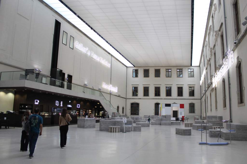
Indeed, as I sat in the enormous atrium, sipping on a coffee from the museum cafe, I decided that I liked this museum even more than the exceptional Old Master’s Gallery. Far from being an interesting secondary city, I had found that Dresden is, in fact, one of the great cultural centers of the country—and, perhaps, of Europe.

The atrium has an appealing Backrooms aesthetic.

When I exited the museum, however, I felt that I’d had my fill of the fine arts for the day. So I opened Google Maps and searched for something different. Soon, I’d found it: the Transparent Factory. This is a working Volkswagen manufacturing plant, designed to be “transparent” in several respects—literally, because the walls are made of glass, but figuratively, because the factory can be visited, and their entire process is on display. In other words, it is kind of a marketing stunt, but still an interesting opportunity to visit a working factory.

I walked in and asked (in German) to be put on the next tour. The clerk, hearing my accent, informed me that the tours were only available in German. Bravely, I said alles gut. Soon I found myself being whisked around the assembly line, listening intently to an explanation that I found almost entirely unintelligible. Still, I had never been in a factory like that before, so it was interesting simply to watch.

Sadly, the factory ceased operations in 2025, the year after my visit. But it is still owned by Volkswagen, and can still be visited.

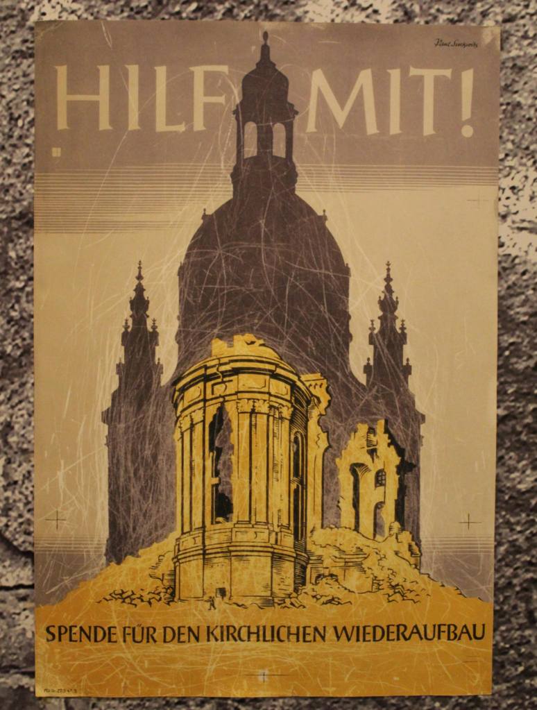
A poster for the fundraising campaign.

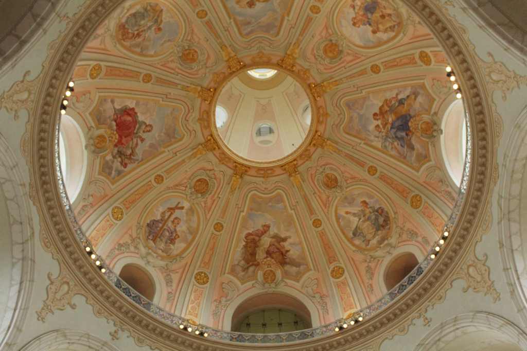
My last stop for the day was, perhaps, the most ironic building in the city: the Frauenkirche. This is the towering Protestant church at the heart of the city. Architecturally, it is interesting—eschewing the usual construction of three naves that culminate in an altar. Instead, it is more of an amphitheater, with the seating surrounding the pulpit—all of this underneath the resplendent dome above (one of the largest in the world).

Like so much of the city, however, this iconic structure was reduced to rubble in 1945. As Dresden was incorporated into the communist (and officially atheist) DDR after the war, there was little political will to invest in the reconstruction of the church; and the pile of rubble was eventually cordoned off and declared a “memorial against war” (rather a lazy choice, if you ask me).

After the reunification of Germany, however, it was finally decided to revive the church and reincorporate it into the newly reconstructed city. The old materials were sorted and cataloged, and a massive funding campaign—with many individual donors—raised the necessary euros. Finally, in 2005, the new church was completed—in time for the 800-year anniversary of the city’s founding. Nowadays, the Frauenkirche, rather than a memorial of war, is a symbol of the city’s phoenix-like rebirth from the flames.

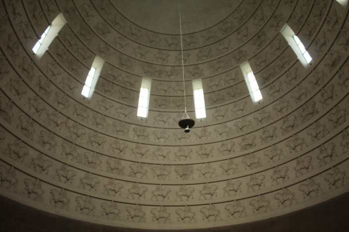
The interior of the dome.

Now, I must skip ahead to my last day. My flight back to Madrid was leaving late in the day, giving me the morning for a last bit of sightseeing. Thankfully, I had saved one of the highlights of Dresden for this: the Dresden Castle.

This is more of a palace than a castle, serving as the seat of power for over four centuries. Of course, like most of the historic city, this too is a reconstruction of what used to be. 

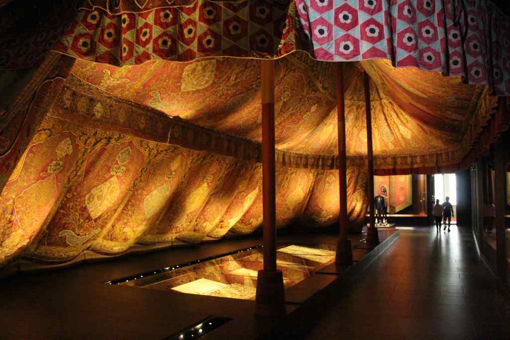
Nowadays no royals live here. Instead, the great structure serves as a museum complex, with five separate sections to visit. There is a wing devoted to prints and photographs, and another one to historic coins (numismatics). More memorable was the Armoury, full of historic weapons and armor. This includes the so-called Turkish Chamber, which displays objects from the Ottoman Empire—notably, a huge and resplendent three-mast tent.

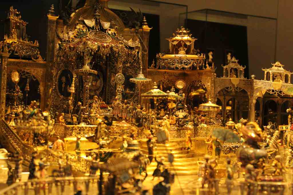
But the highlight of the visit is, without a doubt, the Green Vault. Space is limited; so when you buy your ticket, it comes with an entrance time. It also comes with extra security, as the Green Vault is the home of Europe’s largest collection of precious objects.

The Vault is divided into two spaces, New and Historic. In the New Green Vault, the focus is on the objects themselves. And they are exquisite.

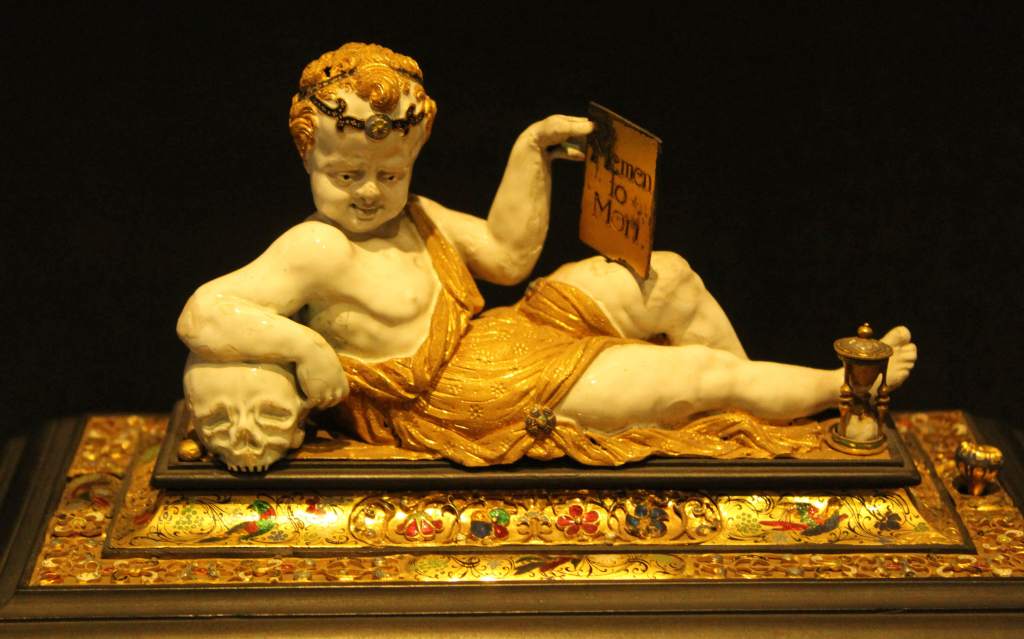
Now, I am normally not such a big fan of jewels and finery. While the craftsmanship is impressive, such objects usually exhibit the wealth of their owners rather than the artistry of their makers. However, the objects in this space were so wildly ornate, and made of such outlandish and rare materials, that I could not help but be impressed. Gold, silver, emeralds, sapphires, rubies, ivory, enamel, amber, marble, pearl, tortoiseshell, coconuts… The amazing attention to detail, the sheer ingenuity of the designs, could captivate even my most cynical mind.

The Historic Green Vault is also full of such delightful treasures, though here the focus is on the total decoration of the rooms. Here you can see the maximalist impulses of the High Baroque in their fullest splendor, as each room bursts with finery. These rooms were put together in the early 1700s under Augustus the Strong, as physical manifestations of his power. But they have been through a lot. Like so much of the city, the rooms were severely damaged—and, in some cases, completely destroyed—in the 1945 bombing. They were also the scene of a famous heist.

In November of 2019, in the wee hours of the morning, a small fire on the nearby Augustus Bridge caused a power outage in the museum, deactivating the security system. While it was down, thieves cut a hole in the window bars and climbed inside the vault—smashing the protective glass and stealing hundreds of jewels.

Amazingly, despite the power outage, the CCTV kept working—which eventually allowed the German authorities to identify and apprehend the thieves (who were all members of the same family). Even better, most of the jewels were eventually recovered, and were returned to the display in August of 2024 (a few months after my visit).

This dazzling display of wealth and power was my final impression of the city. Afterwards, I had time for one last meal (and beer) and the Augustgarten across the river. It was sad to go.

My return flight to Madrid had a connection in Frankfurt (there were no direct flights). Now, layovers tend to produce a certain amount of anxiety in me, since any delay in the first flight can cause you to miss the second. This has happened to me before, and I was afraid it was about to happen again, since my flight was delayed by an hour.

Indeed, by the time I arrived, I had resigned myself to spending an uncomfortable night in Frankfurt. But I was astounded to find that my second flight was also operating with a delay—giving me a 15-minute window to catch it. “You can make it,” the flight attendant told me as I was leaving the plane. “But you’ve got to run. The airport is big!” It was. With my big orange hiking backpack on my back, dressed in jeans and a hoodie, I found myself sprinting down a seemingly endless hallway until, miraculously, I arrived at my gate and, at the last moment, caught the flight to Madrid.

It was an exciting end to what had been a thoroughly enjoyable vacation. And now, unlike everyone else I knew, I could say that I had been to Dresden. And it is a city well worth visiting.

Cobh & Kells Priory

Cobh & Kells Priory

This is a series on my trip to Ireland. The other entries are:


It is a rite of passage for every Irish American to return to the motherland and to visit their ancestral village. Sure, it is ridiculous, and deservedly makes us the butt of jokes. (There is a great SNL skit about this.) After all, it is the most tenuous of connections, a coincidence of genealogy rather than anything genuine. DNA does not remember where it’s from.

But in a country where nearly everyone is descended from immigrants, where identity is constructed out of bits and pieces, and where ancestry can feel bizarrely abstract, there is something therapeutic about going to a physical spot and connecting our genes with soil. At the very least, it gives us a story to tell when we get back.

So it was that, during our drive to Galway from Dublin, we stopped at the town of Longford, where the Farrells supposedly hail from. There were signs of our family name everywhere—literally lining the roads in the surrounding area, as property for sale signs had a Farrell’s name for the realtor. In town, there was a Farrell stationery store. And next to the main road, there was a monument to one James Farrell.

This seemed especially significant, since this is also the name of my late grandfather. But the monument is to someone who passed away before my grandfather was even born—on April 15th, 1912. You may recognize this date: the day the Titanic sank.

James Farrell was, like many of the Irish on board, travelling third class. Just 26 years old, he was bound for New York, in search of better opportunities. He is remembered today for aiding several women escape to the life boats. While the wealthier passengers were being evacuated, those in steerage were kept below deck. James reportedly said to one of the crew members: “For God’s sake man, let the girls past to the boats, at least!” He was obeyed, and several of the women were allowed up and ultimately survived.

This history was hard to fathom while the three of us—my mom, my brother, and myself—looked at the modest monument. “I bet we’re the only people to come here in years,” my brother said. As if on cue, another car pulled up, and out walked—more American tourists. Our search for roots may lead us to see more of Ireland than the Irish themselves.


Fast forward to nearly the end of our trip. Coincidentally, it was my brother’s birthday. To celebrate (perhaps morbidly) we decided to visit Cobh, the last place the Titanic docked before embarking on its fatal voyage.

Cobh is a small town—its population only slightly bigger than my native Tarrytown—located on the southern coast of Ireland. During the days of English colonial rule, it was called Queenstown. After gaining their independence, however, that name obviously would not do; and so the Irish searched for something better. They decided on “Cobh,” the Irish spelling of the English word “cove,” pronounced exactly the same. (The word has no meaning in Gaelic.)

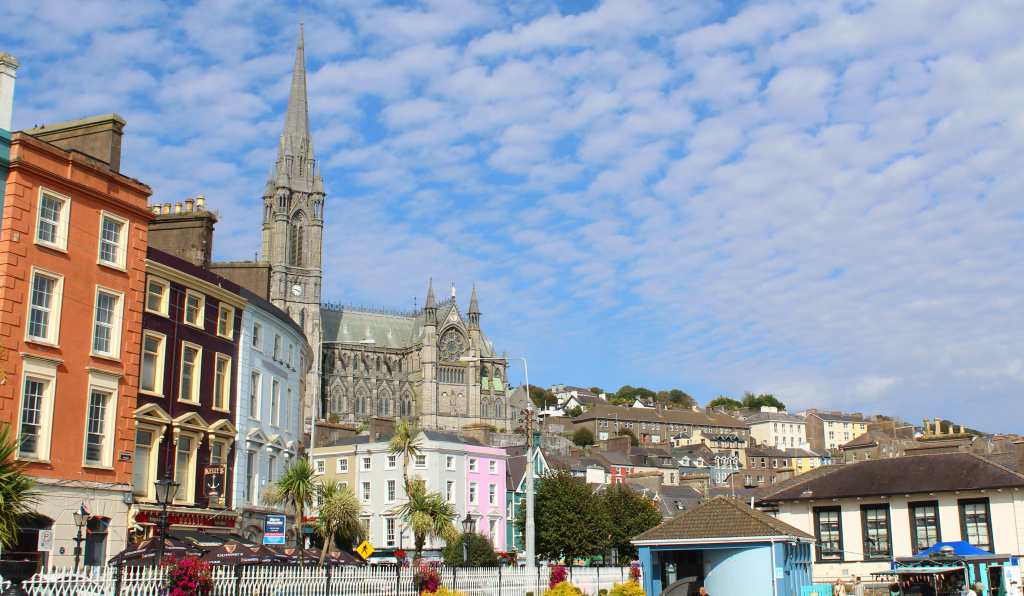
We arrived on a beautiful day, a few fat clouds hanging in the sky like overfed sheep, the water glistening in the bay. After parking the car, we were greeted by the sound of church bells. Cobh, you see, has a strangely magnificent cathedral for such a small town. Built in a neo-gothic style, its single spire soars into the air, dwarfing every other structure in the vicinity.

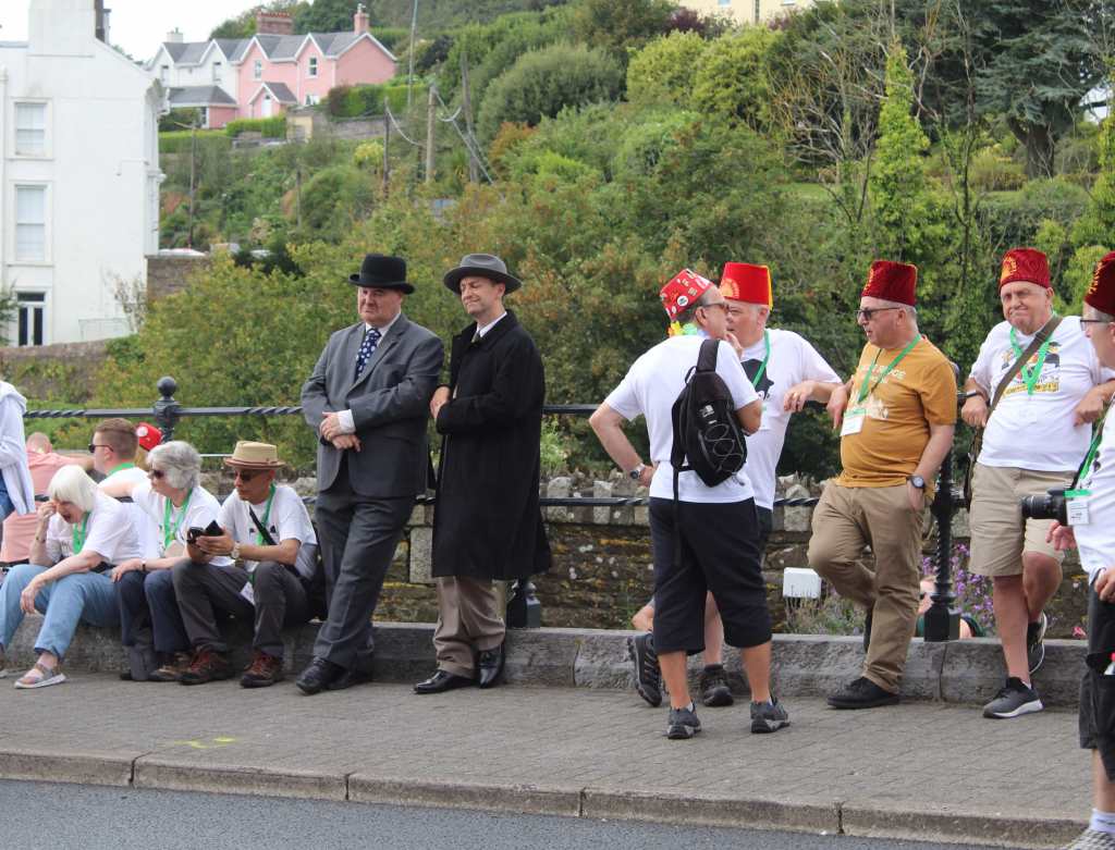
As we approached, we noticed a crowd was gathered around the church, listening to the bells. Strangely, every one of these people was wearing an identical red fez cap. To add to the confusion, there were also two fellows with Hitler mustaches who were dressed in old-fashioned suits and top hats. We listened, and soon realized that this wasn’t merely the tolling of bells, but a concert. Inside, we could see a video feed of a man playing on a keyboard. The church itself was acting as a kind of enormous instrument.

By asking around, we found out that this was all part of a conference of the Sons of the Desert. This is the official fan club of Laurel and Hardy, the legendary comedy duo. The two men with mustaches were impersonators (and quite convincing ones), while the red caps are a reference to a 1933 film, which shares a name with the organization. Even the concert was part of it: the music being played on the church bells were themes from the movies. The whole spectacle was oddly delightful. Although none of us knew anything about Laurel and Hardy, the overwhelming enthusiasm devoted to this niche bit of cinematic history was thoroughly charming.

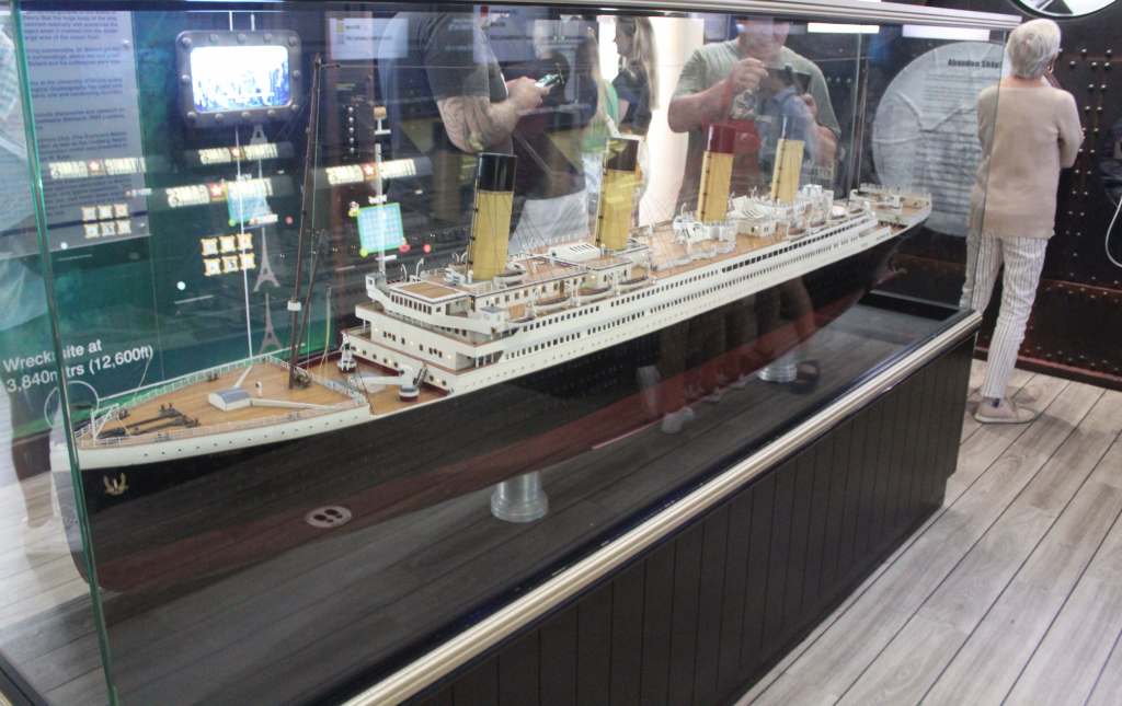
The main thing to do in Cobh is to visit the Titanic Museum—or, as they call it, “Experience.” This is located in the old White Star Line building, where the passengers bought their tickets and boarded the doomed vessel. Each ticket features a profile of one of the 123 passengers who embarked from Cobh (fewer than half survived). The visit itself is a kind of guided tour, which takes you through models of different cabins, tells stories of some individual passengers, and includes a remarkably bad CGI portrayal of the sinking. It is a bit corny and rather touristy, but still a fun way to pass an hour.

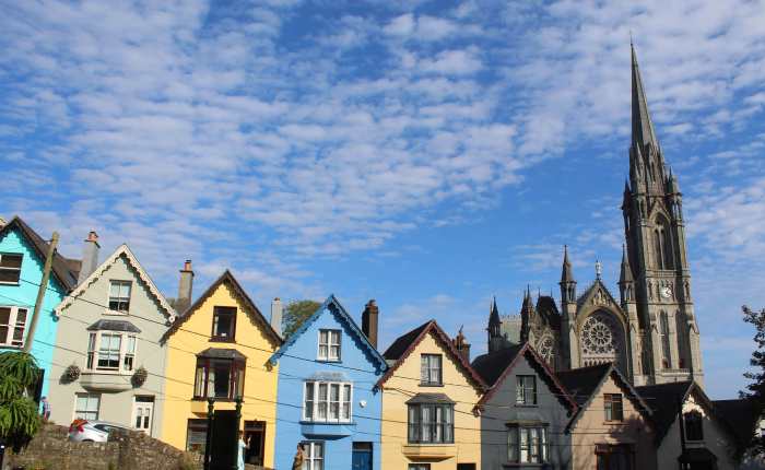
The town of Cobh itself is a lovely place—picturesque, cozy, atmospheric. A row of Victorian houses running down a hillside, all of them painted a different color, creates an image reproduced in countless post cards and screen savers. Next to the water, you can see a statue of Annie More, the first Irish immigrant to be admitted through Ellis Island. And though my own ancestors entered the United States years before Ellis Island opened its doors, they must have taken a very similar journey across the stormy, gray Atlantic—the same trip, indeed, that James Farrell was on when his vessel crashed into the ice.


On our drive back to the Airbnb to cook my brother his birthday meal, we stopped at a place we found in our trusty Rick Steves guidebook: Kells Priory.

Kells Priory is not the monastery that gave its name to the famed Book of Kells, which is located much farther north. This monastery was founded later, at the end of the 12th century; and it has a storied past. Attacked and burned on three separate occasions—notably by Edward Bruce, who tried to make himself king of Ireland in the 14th century—the monastery also has an odd connection with witchcraft.

In 1324, a wealthy and powerful woman in County Kilkenny, Alice Kyteler, was accused of heresy by her stepson. A bishop came to investigate the accusation (which unsurprisingly was based on personal resentment) and was imprisoned by the local lord, in this very monastery. Eventually, the bishop was released, but Kyteler had time to flee the country. She was never heard from again. But a poor maidservant, Petronilla de Midia, was accused of being her follower, tortured, and burned at the stake—the first known such case in Ireland.

Like so many other monasteries, Kells Priory was dissolved in 1540, under the orders of Henry VIII, who wanted to remove his kingdom from Catholic power (so as to have more leeway to decapitate his wives). Since this, it has lapsed into one of the many ruins which dot the Irish landscape.

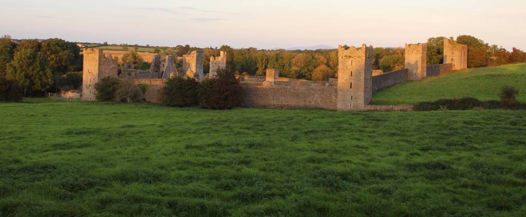
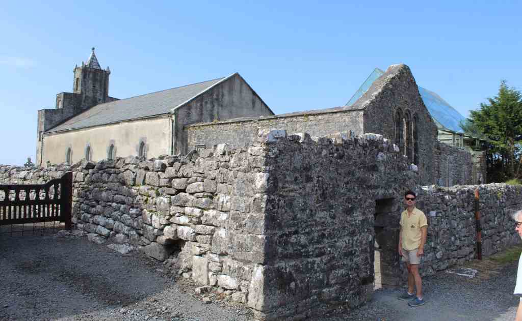
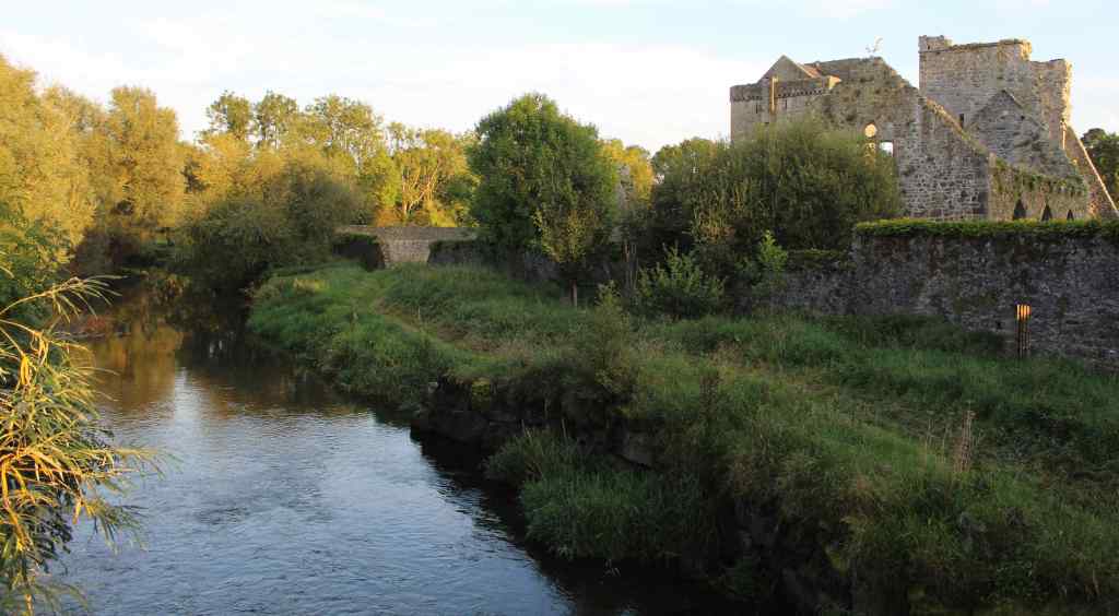
But it is an arresting ruin. Situated in an open green field, the monastery presents itself to the viewer as a collection of towers, connected by a wall. In other words, it looks more like an abandoned castle or fortress than a religious institution—perhaps unsurprising, given its conflicted past.

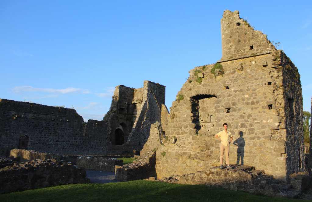
My brother on his birthday

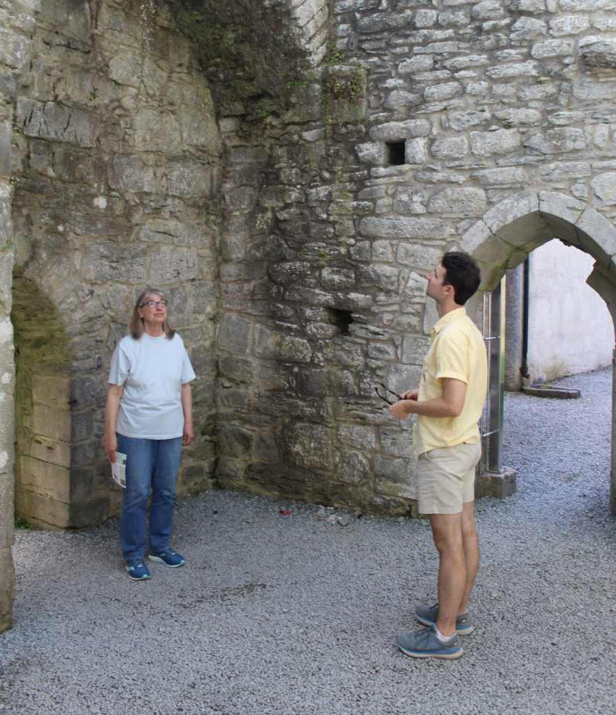
When we visited, we were the only people there. It felt like stumbling upon a secret. With the sun low in the sky, we wandered among the ruins—walking up staircases that led nowhere, balancing on demolished foundations, and passing through empty doorways. The ruins were vast, covering the whole hillside, and yet there was little if any signage. When we got to the other side, we found a river flowing quietly alongside the stony pile, where a few locals were strolling, inured by overexposure to the majesty of the ruins.

This was not to be our last glance of Irish ruins—that would be Glendalough—but it was the most evocative. To American eyes, such a place deserves to be world-famous. But in Ireland, and in Europe generally, it is a historic footnote—just one monastery among hundreds. In such a small country with such a deep past, the years seem literally piled up beneath your feet, constantly reminding you of the lives which have come and gone. Having grown up in such a place, it must have felt like a tremendous rupture for those like my ancestors to leave this land behind and step foot on a new continent.


The rest of our night was delightful. We went back to the Airbnb—a cottage in the countryside—and cooked birthday pasta for my brother. Then, we watched Irish public television. As soon as we turned it on, we were amazed to be watching Stan & Ollie, the Laurel and Hardy biopic, which features a scene in Cobh. Surely, that cannot have been a coincidence. That movie (surprisingly good) was followed by The Patriot, one of the most anti-British films of recent history. It seemed appropriate for the Republic of Ireland.

It had been a strange day, and yet oddly appropriate for the end of our trip. We had come to Ireland, in part, in order to wring a little bit of meaning out of our past. And in different ways, this is also what we did by celebrating my brother’s birthday, or what the Sons of the Desert did by visiting Cobh, or what the public television did by playing The Patriot. Ireland is, of course, far more than a landscape of ruins, or a playground for Americans to find their roots. It is, as we discovered, a thoroughly charming country—whose people, places, and past all promise a great future. And I look forward to seeing it.

The Rock of Cashel & Kilkenny

The Rock of Cashel & Kilkenny

One thing that an American visitor quickly learns on a trip around Europe is that there are simply some parts of the landscape that cry out to be the site of a castle. At a time when every town was its own kingdom, a time before police forces or standing armies, a time of great scarcity and instability, it was only the presence of a castle that could guarantee the safety of the local ruling family. And the safest place for a castle is usually on the highest available ground—where enemies can be spotted from afar, and where attackers must struggle uphill. The outcropping of limestone that rises dramatically over the fertile, level land known as the “Golden Vale” is just such a place—a natural pedestal. You might even say that it was destined to be the site of a great edifice.

The Rock of Cashel has been important in Irish history for a very long time. Indeed, it is difficult to say precisely how long. There are legends about its formation—about St. Patrick confronting Satan, who then hurled this great rock from a nearby mountain—and there are stories about the early Christian leaders, Patrick and Declán, meeting here all the way back in the 5th century. What we can say with more certainty is that this was the seat of the kings of Munster, who ruled this corner of Ireland from the Iron Age all the way to the Middle Ages. For this rocky outcropping, in other words, geology became history.

By the time we drove up and parked in the shadow of this old pile of rock, it was the middle of a hot, sunny day. We walked up the hill to the entrance and signed up for the next available tour, which luckily was about to start. Our guide was—like so many Irish—eloquent, witty, and engaging, leavening her historic spiel with the right amount of humor. Still, during my visit, I found it difficult to pay attention. The ruins were so vast and so evocative that I felt swallowed up, overwhelmed by their scale and splendor.

But time alone is not solely responsible for the building’s ruined state. Although the Rock of Cashel was a fortified castle for centuries, religion eventually overtook politics as the dominant local force, and a large Catholic cathedral was instead built in its place. Yet such a prominent symbol of Catholic power was an obvious point of resistance during the Irish Rebellion of 1641; and it was an obvious site of English reprisals in the following Irish defeat.

The invading troops massacred the Catholic clergy and looted the church. Among the dead was Theobald Stapleton, one of the fathers of Irish orthography. Henceforth, the cathedral came to be used by the Anglicans. The English clergy were, however, little disposed to invest in the upkeep of the cathedral, which fell into disrepair. Finally, Arthur Price, the local archbishop, overruled plans to repair the roof—considered a jewel of Irish architecture—and had it dismantled, thus leaving the ruin we see today.

But some parts of the original structure remain standing—most notably, Cormac’s Chapel. Completed in 1134, this is a Romanesque chapel, one of the finest in Europe. Unlike the flashy Gothic architecture of the high Middle Ages, this chapel strikes the modern viewer as elegant, meditative, and soulful. Unfortunately, the builders of this chapel used sandstone—which has an attractive hue, but which soaks up water over time. This severely damaged the wonderful ceiling frescoes, as well as weakened the structure. Nowadays, the interior is climate-controlled, and visitors can only enter in small groups, for a limited amount of time.

The other notable structure on the site is the round tower. This is a distinctly Irish design, consisting of a free-standing stone tower with a pointed roof. The one here is nearly 30 meters (100 feet) tall, and was built before the cathedral was even started. The purpose of these towers is somewhat mysterious: they would not make good bell towers (there isn’t room or a sizable window), and they were not used for storing grain. Because they had such a small foundation, it was structurally necessary to put the entry door well over the ground, accessible only by a ladder. Our guide explained that this made the towers ideal places for the monks to hide during attacks, as the ladder could be withdrawn into the tower and the door tightly shut.

Our tour ended on the northern side of the site. In the far distance, the low, lush fields of the Golden Vale spread endlessly outwards. After the cathedral’s destruction, the hill was still used as a cemetery for many years. Many graves thus adorn this side of the hill, giving a somber mood to an already haunting place. As usual in Ireland, many centuries seemed to be compressed beneath our feet.

Learning history is tiring work, so we next headed to a nearby restaurant for some hearty Irish fare. And this gives me an opportunity to talk about Irish cuisine in general. Most people, I would reckon, do not visit Ireland for the food, and it is not especially well-known outside the country. Nevertheless, I found it to be consistently comforting and enjoyable. Both literal and figurative meat and potatoes, it is honest, hardworking food that will keep you fit and fed all day. Yes, it is somewhat bland; and yes, it sits a bit heavy in the stomach. But it does exactly what it promises to do. Besides, if you get tired of it, Ireland is well-supplied with cuisines of other varieties. During our time there, we had good Italian, Indian, and Mexican food.

Our next stop was the nearby town of Kilkenny, just an hour’s drive away. We were behind schedule. It was already afternoon, and we had only allowed for a single day to see the city. After finding a place to park, we rushed to the town’s main attraction, Kilkenny Castle—only to be informed that it would close in an hour. Our visit was thus abbreviated.

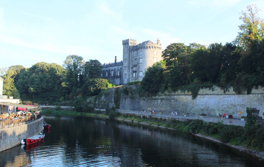
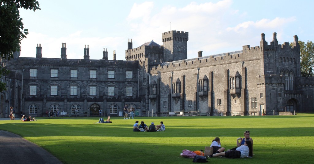
If some castles seem to emerge from the landscape, others are imposed on them in order to exert control. This is precisely the origin of this fortification, which was built along the River Nore—a natural choke point for commerce and travel. Kilkenny Castle does not have the same antiquity as the Rock of Cashel. Instead, this building came about during the Norman invasion of the 12th century. The Normans came bearing a new language (French) and continental ideas of architecture. If the Rock of Cashel is a symbol of Irish identity, then, Kilkenny Castle is a symbol of foreign occupation.

Ironically, however, this castle was also used as a headquarters of the aforementioned Irish Rebellion of 1641. Indeed, it was even used by the provisional Irish parliament. But Oliver Cromwell put an end to that. His troops besieged the town and, in the process, damaged the castle—brutally suppressing the rebellion and instituting laws that would severely reduce the rights of Catholics.

The castle is now a museum, thanks to the 6th Marquess and 24th Earl of Ormonde, who donated it to the Irish government in 1967 for the symbolic sum of 50 pounds—long after his ancient family had run out of the necessary funds for its upkeep. In his words: “We determined that it should not be allowed to fall into ruins. There are already too many ruins in Ireland.” Of course, after decades of neglect, the castle was already quite dilapidated. It took many more years to restore it to its present glory. 

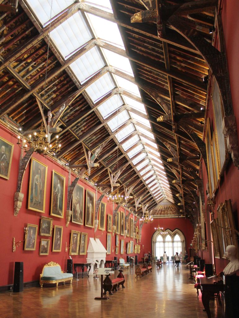
What the visitor encounters now is not so much a fortification as an aristocratic home. There is elegant furniture, richly woven tapestries, and lovely floral wallpaper. The showstopper is the picture gallery—an enormous room with wooden vaulted ceilings, every inch elaborately decorated. Even the fireplace is intricately carved. Yet despite the many attractive paintings adorning the walls, I found the ceiling to be the most impressive. Every single board was shaped and painted.

Soon our tour was over, and we were deposited in the sweeping lawn of the castle grounds. It was a delicious evening—warm, cloudless, and still quite bright—and this great lawn, which now serves as a city park, was full of people. We sat on a bench and took it in. A group of high school boys caught my attention. Their backpacks on the ground (it was a school day), they were tossing a ball back and forth with wooden sticks. This is hurling—the quintessential Irish sport, which requires great dexterity to manipulate a small ball with a kind flat wooden club. There, in the shadow of a fortress built by invaders, the Irish culture blithely soldiered on.

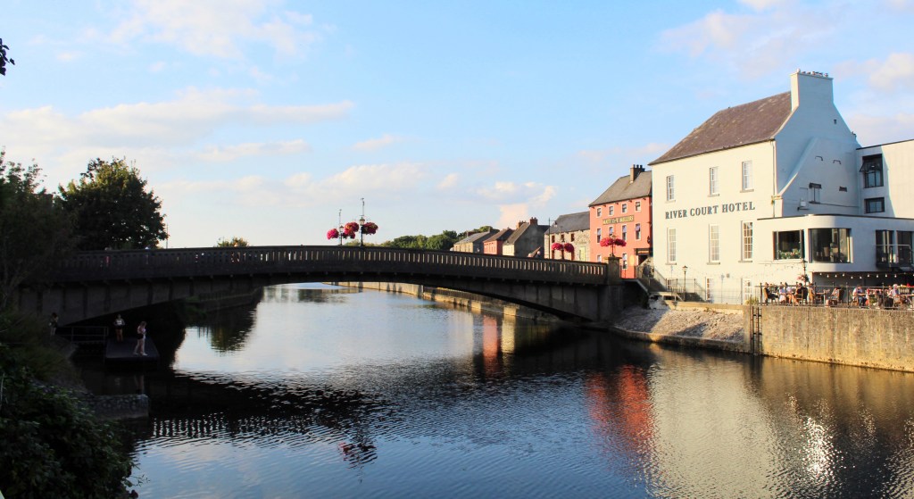
It was our misfortune not to have had more time for Kilkenny. One of the most charming and best-preserved cities in Ireland, it is worth a longer visit than we allotted. Still, we enjoyed strolling the streets and walking alongside the placid waters of the River Nore. Indeed, as we searched for a restaurant, we observed a group of school-age girls taking turns jumping into the river. With nobody else around, it felt like a strangely intimate moment in a small town, rather than something I expected to see in a center of medieval Norman power.

As the 6th Marquess and 24th Earl of Ormonde observed, Ireland is indeed quite full of ruins. And yet among them, above them, and between them, it is also a living place.

The Cliffs of Moher & the Burren

The Cliffs of Moher & the Burren

“Make sure to apply plenty of sun cream,” the radio advised, “and take it easy on the beer. One or two is fine, but any more and you might get dehydrated.”

This was the voice of an expert on public health, speaking on Ireland’s national radio station, RTE. Ireland, you see, was experiencing a heat wave. The skies were clear and sunny, and the temperature was reaching highs of… around 25°C (75°F). In other words, the weather was absolutely perfect. But on this rainy island, such scorching temperatures were worthy of serious news coverage.

Meanwhile, we rode down country roads, windows down, soaking in the effervescent green of the Irish countryside. We were on our way to one of Ireland’s most famous natural wonders: the Cliffs of Moher.

Now, here I want to add a note about RTE. Despite the official name being in the Irish language (Raidió Teilifís Éireann), RTE primarily broadcasts in English. This makes it an absolutely delightful resource for any American travelers to the Emerald Isle. Just by turning on any car radio, you are given an immersive window into the realities of Irish culture. During our trip, we listened every time we were in the car, hearing programs about budget negotiations, interviews with cookbook authors, and discussions of rising energy prices. This may not sound especially engrossing, but it made our visit feel that much more intimate.

The health expert elaborated on the dangers of sunburn and dehydration as our destination came into view: the visitor centre. You know you have arrived when you see the huge parking lot across the road, which on any given day will be full of tour buses and private cars. The cliffs are free, but the parking is not.

The visitor centre is worth stepping into before you see the cliffs. Opened in 2007, it was built into a hillside to better preserve the natural environment. Aside from serving snacks and having public toilets, the centre also has small exhibits on the geology, history, and wildlife to be found on the cliffs. But the detail that most sticks out in my memory are the women working at the gift shop, who were visibly red and covered with sweat due to the heat wave—despite my feeling entirely comfortable. I suppose it matters what you’re used to.

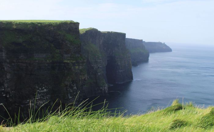
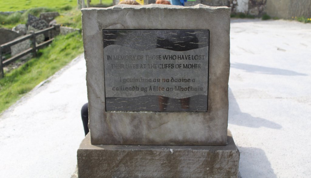
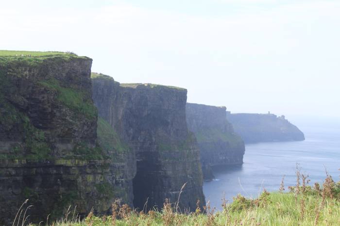
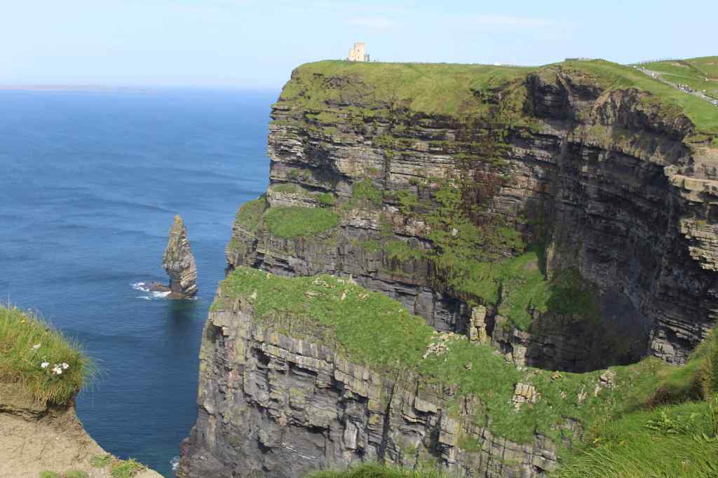
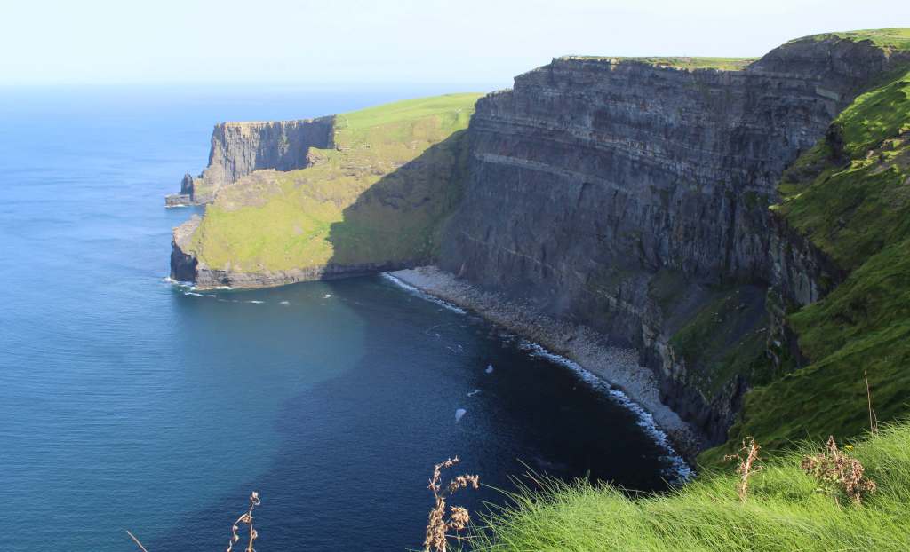
It is a short walk from the visitor centre to the edge of the cliffs. The first view is breathtaking—as is every view after that. Though it is cliche to say it, the photos simply do not do justice to the cliffs. Their scale is unlike anything I have ever seen. Standing at over 100 meters (or around 330 feet) above the sea, and stretching for miles in both directions, the cliffs are an overwhelming spectacle—one of the few tourist attractions that stand up both to the hype and to the inevitable hordes of tourists. 

We like to say that Rome was not built in a day, but geological time operates on a scale that dwarfs even our longest empires. These cliffs are a case in point. What we see today is the process of hundreds of thousands of years of water erosion. The process is simple: the waves crashing into the rock eventually cause a notch in the area touching the sea. As this gets deeper, it cannot support the weight of the rock above it, and the whole side of the shore comes crashing down. This is how we get these sheer rock faces.

Due to this erosion, a huge layer of rock is exposed to the eye. This is what geologists dream of. It is the history of the earth, exposed to public view. The rock here is sedimentary, meaning that it was deposited by ancient rivers, and compacted into layers of hard shale and sandstone over time. As you might expect, the oldest rocks are at the bottom; these date back over 300 million years, before the time of the dinosaurs. The fossils preserved in the rock are the traces left by tiny burrowing creatures who lived in the ancient riverbed.

Yet viewing the cliffs does not put most visitors in the mood for scientific inquiry. Instead, they invite a sense of gaping wonder at the scale and majesty of nature, even amid the famously docile landscape of Ireland. My brother and I wandered up and down the path, taking photos of the cliffs from different angles, none of which was wholly satisfactory. Seabirds glided in the strong currents of air that formed from the ocean wind hitting the rock face—and which sent the sharp scent of salt water up to the viewing platforms.

But enjoying a spectacle is hard work; so, feeling hungry, we wandered off to find a vegetarian hamburger truck that we had heard about (it was very good). Our mom, who wasn’t very hungry, stayed behind at the visitor center. By the time we got back, she was enjoying a performance of a marching band that had set up in the large seating area outside. It was an odd contrast—this austere icon of Ireland, and music that would not have been out of place at an American football game. But, strangely, it only added to the pleasant atmosphere of the unseasonably warm day.


The rest of our day was yet unplanned. We figured that we would be able to find something interesting in the vicinity of the Cliffs of Moher, and we were right. With our trusted Rick Steves guidebook in hand, we opened to one of the many maps, and found that we were near an area called “the Burren.” The name alone sounded strangely promising.

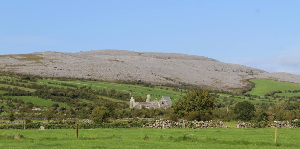
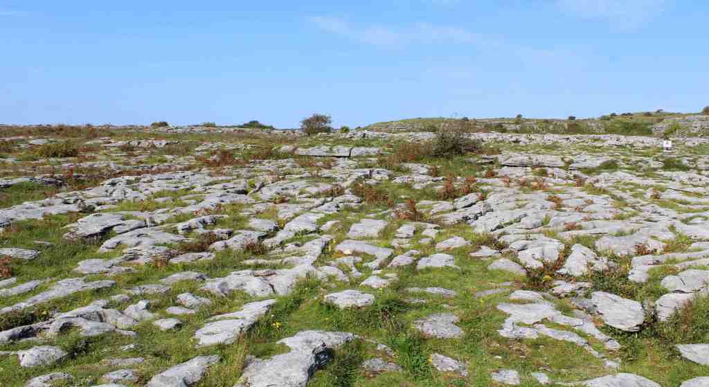
As we drove into the area, the landscape began to change. The hills of grass that characterize the country become relatively flat, and covered in rock. Indeed, from a distance you could see how the landscape abruptly shifts, the trees and greenery giving way to swirls of gray stone. Getting closer, we could see that the ground was blanketed with a natural pavement—a series of flat stones forming a solid surface, between which grass and flowers grew. It produced an immediate impression—a landscape of stark and ancient beauty.

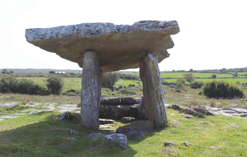
This impression was magnified at our first stop: the Poulnabrone Dolmen. This is an ancient megalith, well over 5,000 years old. As it stands now, the structure consists of three upright stones supporting a slab roof. But this is only the “skeleton” of the original construction. In its time, it would have been covered in soil and topped with a “cairn,” or a tower of rocks. Even so, it is an impressive sight. The arrangement of stones looks fragile, as if it can topple over at any moment. The visitor cannot help but wonder how it survived for so long. It is also impossible not to wonder how the stones were moved into this arrangement without the help of modern technology. The roof stone is so large that I don’t think even several dozen people could safely lift it.

The short walk from the parking lot to the dolmen was unusually difficult, owing to the curious topography of the Burren. You have to be aware of where you are putting your foot, or you may step from the high platform of rocks into one of the crevices between them—thus risking a twisted ankle. Yet this extra awareness gives the Poulnabrone Dolmen an added spiritual element, as the visitor is forced to focus on their surroundings. This, added to the peculiar beauty of the landscape—quiet, empty of birdsong, isolated and exposed, as if you were on the top of a high mountain—lends this lonely monument a mystical atmosphere, as if it really were the portal to another world. 

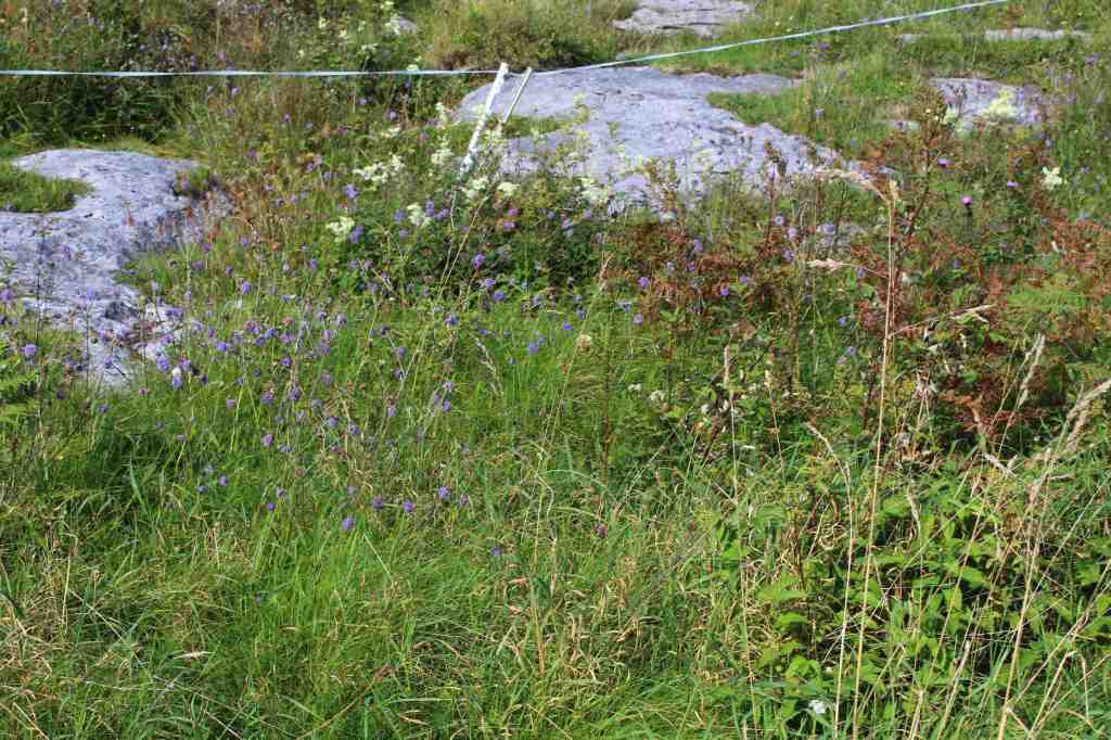
Our next stop in the Burren was the eponymous visitor centre. Located in the exceedingly small village of Kilfenora, this institution does not look like much from the outside. But it is well worth a visit. A small fee will get you into the museum, which has all the information you could want to learn about the Burren—flora and fauna, geology, history, and even music. I found the information about the flora to be especially interesting. Puzzlingly, this rocky and barren landscape is home to over 70% of the country’s native plant species, many of them wildflowers. Even more puzzlingly, alpine and mediterranean flowers bloom together here. The deep groves in the limestone apparently provide an ideal micro-environment.

Another highlight of the visitor centre is the Kilfenora Cathedral, which today lies mostly in ruins. This attractive church building is now used to exhibit a collection of High Crosses, which are large stone crucifixes. These monuments, dating mostly from the early middle ages, are often decorated with elaborate images—illustrating Biblical stories at a time when most people were illiterate. The finest of these can rival the great gothic tympanums (the area over a doorway).

My mom and brother, admiring the ruined church

Yet during my visit, another parallel came to mind. In Galicia, the northwest of Spain, the landscape is also dotted with tall stone crucifixes, called cruceiros. This parallel struck me as odd, as Galicia is also home to many prehistoric dolmens—some that are remarkably similar to the one I had just seen here. Perhaps this should not be too surprising, however: both Galicia and Ireland were once populated by Celtic peoples. Indeed, there was once a time in human history—over 10,000 years ago, during the last great Ice Age—when it was possible to walk from Spain all the way to Ireland. This may seem like a very long time, but it is just a moment in the history of the earth.

Perhaps I am thinking in these terms because the Cliffs of Moher and the Burren both evoke the deep, geological past of Ireland, and remind us that the land beneath our feet is far more than just a country.

Galway & Inishmore

Galway & Inishmore

“Dublin is fine, I guess. But you gotta see Galway. It’s incredible.”

My friend Durso had told me this on my first trip to Ireland, launching into a long glowing description of the coastal city. Now, six years later, it was my chance to finally see this mythical place. How would it measure up?

By the time we arrived—after a long day of driving—it was already evening. We headed into the center of town without a plan or even knowing what to expect. All I knew was that Galway was supposed to be nice. 

Galway, a medium-sized city, is situated on the western coast, almost directly across from Dublin. The city was once an important port for commerce and fishing. Nowadays, its economy has two new pillars: tourism and education. The latter is especially important. Of the roughly 85,000 residents of the city, nearly a quarter are students at the University of Galway. For a place with so much history, it has a very young population.

This was immediately apparent to us. As it happened, the day we arrived was Freshers’ Day, when all of the first-year students are welcomed to campus. A parade of young people marched down High Street, all of them looking lost and amazed—overwhelmed by their new-found independence. And, crucially, unlike in my own country, freshmen in Ireland are of drinking age. It was bound to be a wild few nights.

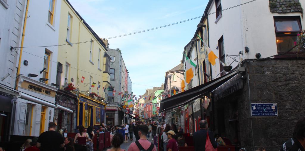
This youthful presence—combined with the plentiful tourists—gave the center of Galway a raucous energy. Every bar was packed, every restaurant was full, and we had to dodge between crowds and street performers. I had imagined a picturesque old fishing village, and this was a nightlife district.

But the city is well-adapted to hungry and thirsty crowds, and we soon managed to satisfy our bodily desires. After dinner, we searched for a bar that wasn’t overwhelmed by students. Eventually, we decided on Tig Cóilí, a tranquil place with classy wooden furnishings. This is one of the many whiskey bars in the city. After asking the barman for some advice, I had a glass of Micil Invernin, a single-malt whiskey with a pronounced smokey and peaty flavor—reminding me very much of Laphroaig Scotch. This was followed by a delicious Irish coffee, whose mixture of alcohol and caffeine produced a strange wakeful drowsiness.

The rest of our stay in Galway consisted mainly of mornings and evenings, as we had several day trips planned. This meant that our impression of the city was inevitably skewed. Nevertheless, it is fair to say that Galway is not a city of many attractions. Though historic, only fragments of the city’s medieval past remain.

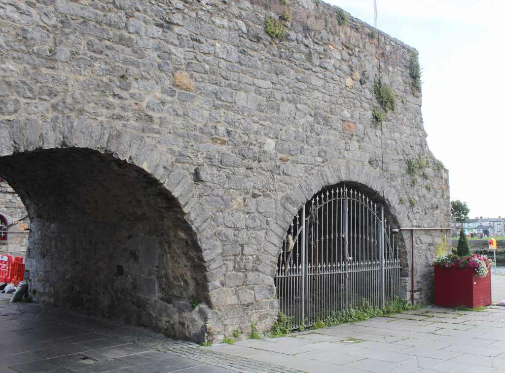
Notable among these is the so-called Spanish arch, an extension of the city walls (now mostly gone) down to the docks. There is nothing particularly Spanish about this arch. It got its name because of the many Spaniards, usually merchants, who used to visit Galway, mooring their ships near this arch.

It is hard to get very excited about the Spanish arches.

Indeed, Christopher Columbus himself (who DNA studies reveal to have had a Spanish origin) visited Galway as a young man, and spoke of seeing “Cathays” (the antique word for Chinese people) who had arrived on logs. These people were almost certainly not Chinese, but may have been Inuits who were blown across the Atlantic in a canoe. Nevertheless, it reinforced his belief that a voyage to Asia was possible by sailing west.

All of this history was unfathomable, however, as we wove our way through the young crowds. Galway is certainly not a city oriented towards the past. Indeed, for a place with such a romantic setting—the stormy Atlantic brooding in the gray distance—and with the soothing sound of water continuously nearby, Galway is a surprisingly energetic place. Perhaps it is no wonder that my friend, who visited during his drinking years, loved it so much.

I do want to single out Il Vicolo, an Italian restaurant we visited. Now, I am normally opposed to eating Italian food out unless I am traveling in Italy. It seems like a wasted opportunity to eat something available everywhere, rather than trying the local food. But in this case, the decision turned out to be a good one. The restaurant—in a historic building overlooking the river—was attractive, and the food a welcome relief from the heavy Irish fare.

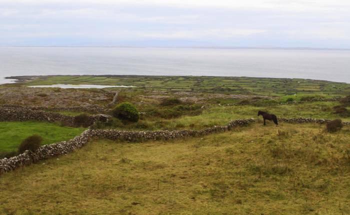
Lost amid the crowds and the nightlife, I did not appreciate the impressiveness of Galway’s natural setting until it was time to leave it. On our first morning there, we boarded a bus that took us from Galway to Rossaveel. We soon left the city and were being swept along a fairly suburban area overlooking Galway Bay. The morning was gray and overcast, and the landscape had none of the usual sweetness that one associates with Ireland. Instead, it was rocky and desolate, almost reminding me of Iceland. The North Atlantic is a harsh and dramatic environment. 

We were there to catch a ferry to the Aran Islands. These are a group of three islands that lie at the westernmost point of Ireland. Inishmore is the largest and most popular of these, and this was our destination. The trip lasted about an hour and deposited us in Kilronan, or Cill Rónáin (in the official Irish spelling), the only place on the island approaching a proper village. With a population of less than 300, it is home to over a third of the island’s inhabitants—which gives you some idea of its remoteness.

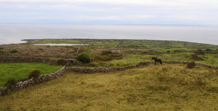
If Galway struck me as a place with too many people and not enough history, Inishmore was exactly the opposite. Despite the boat loads of tourists (we among them), and despite the island’s relatively small size (about half as big as Manhattan), the island creates a powerful sense of isolation in time and space. The landscape is windswept and bleak—deforested after centuries of human habitation, and littered with ruins, both old and new.

We immediately set about procuring ourselves a tour. Now, there are many options for visitors to the island. You can rent bikes and explore on your own, or even just take off walking. The most popular option, however, is to sign up for a minibus tour. There is no need to book in advance. As soon as you leave the ferry, a host of tour operators confront you, all of them offering pretty much the same tour at the same price. We signed up for one without any research or planning, and it ended up being fantastic.

Our guide soon whisked us into the rocky center of this island. Speaking rapid-fire into a microphone, he gave us a running commentary on everything we were driving past. And he had a lot to say. Aside from being a tour guide with ample experience, he was also a native of the island, and could frequently add a personal touch to his narrative. Now, I admit that I have forgotten the vast majority of what he said—he spoke fast, and in a thick accent—but I do remember the sense of wonder I had, as he effectively pulled us into what it was like to grow up in such a place.

I can attempt to write a description of the island here—its rugged hills of pale green, ringed by rocky shores and covered in gray ruins—but I think it would be better just to instruct any curious readers to watch the film The Banshees of Inisherin. This film—properly tragic-comic, as are so many Irish stories—was filmed here, and does a wonderful job in capturing the combination of desolate beauty and provincial isolation.

One valuable part of the experience was simply overhearing the guides speak Irish. You see, Inishmore is a Gaeltacht, which is a section officially designated as having Irish as the first language. Language has a political element here, as it does in so many other parts of the world; and adoption of Irish (also called Gaelic) as a co-official language with English was seen as an important step in the assertion of Irish identity. Nevertheless, the overwhelming majority of the population still speak English, and learn only minimal Irish in school. Inishmore is one of the few exceptions to this rule.

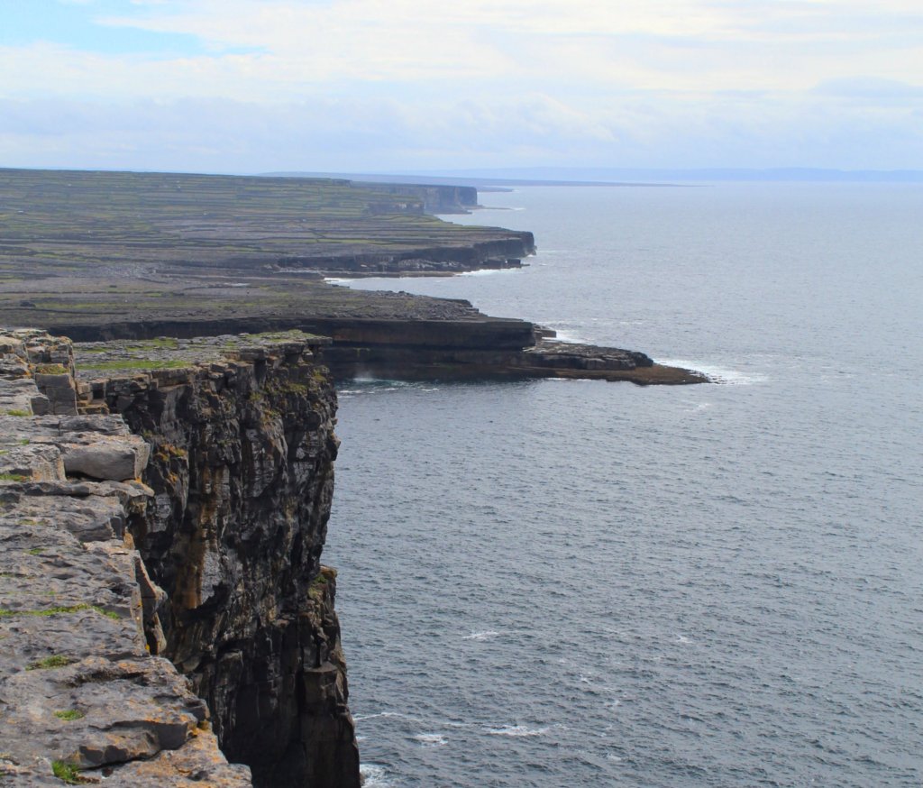
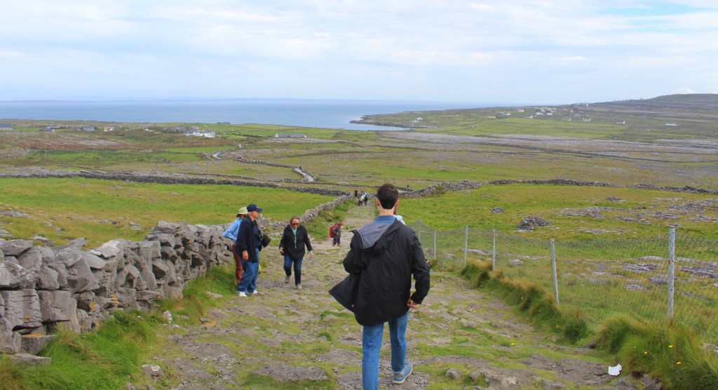
The high-point of the visit, literally and metaphorically, was Dún Aonghasa. This is an ancient fortress, situated high on a cliff overlooking the Atlantic. Even the approach is dramatic. Stumbling over a rough cobblestone walkway, ringed by stone fences, the visitor gets a small taste of how secure this place must have been in its time. The surrounding fields are strewn with spiky stones that would have disrupted any approaching army.

Nearer, the visitor passes through a series of four concentric walls. Even today, after years of neglect and decay, they stand far taller than a person, and are thick enough to withstand serious force. (Admittedly, major sections of the walls have been restored.) Clearly, the people who built this fortress did not want to take any chances. But who were they? Archaeologists are not entirely sure. The fortress seems to have been built sometime around 500 BCE by the Celtic inhabitants. Its name may refer to a god from Irish mythology. That is about as much as we know.

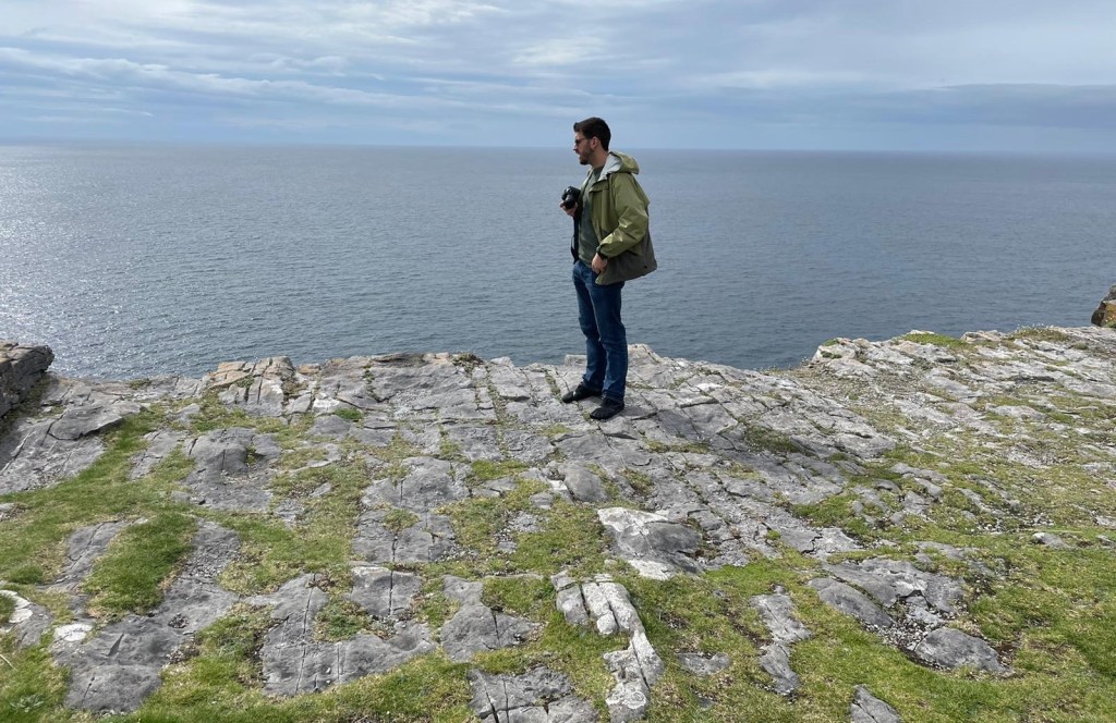
Today, it is impressive more for its setting than for anything it can tell us about prehistoric Ireland. Hanging precipitously from a cliffside, the fortress suggests a people who were surrounded by enemies, who lived with their backs to the wall. The day we visited was fairly mild. Even so, the Atlantic looked brooding and dangerous in the distance, an angry infinity waiting to swallow up this floating bit of rock. It must have been an exceptionally hard life.

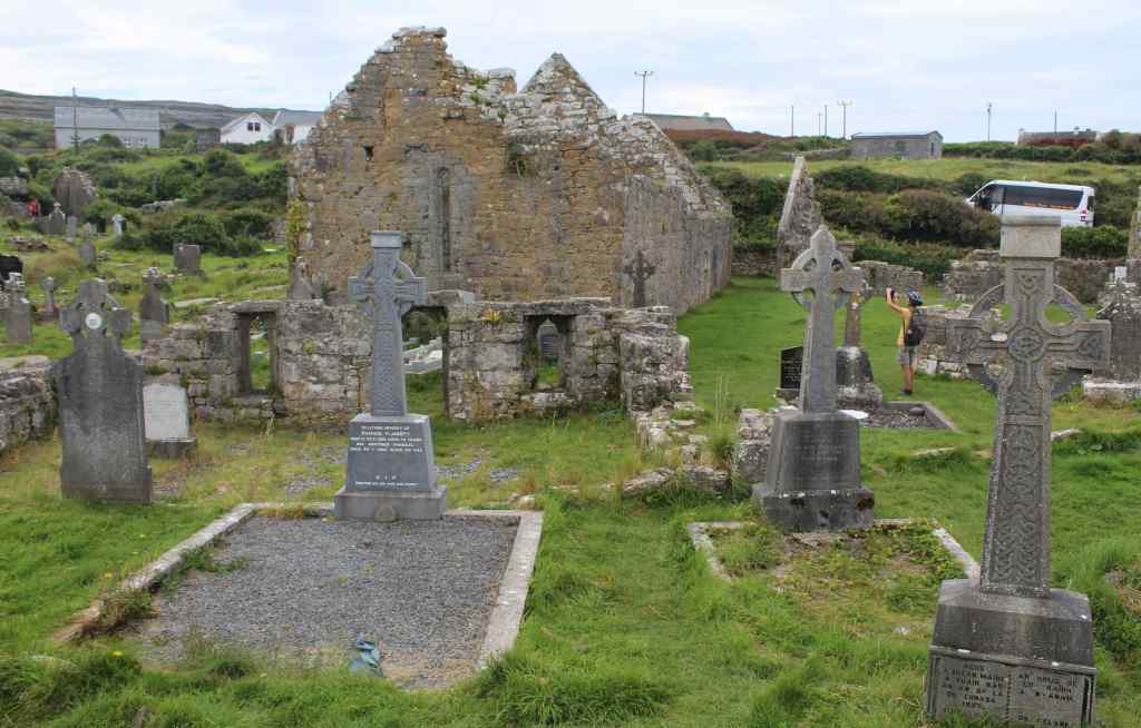
The other major historical site on the island are the Seven Churches. This is a somewhat misleading name, as there are only two churches at the site, and they are both in ruins. Our guide told us that they were “early Christian” structures, though he couldn’t offer much in the way of specifics, aside from mentioning that they used to be important destinations for pilgrims. The dilapidated and unused churches are surrounded by a still-active graveyard, which gives the place a rather spooky air.

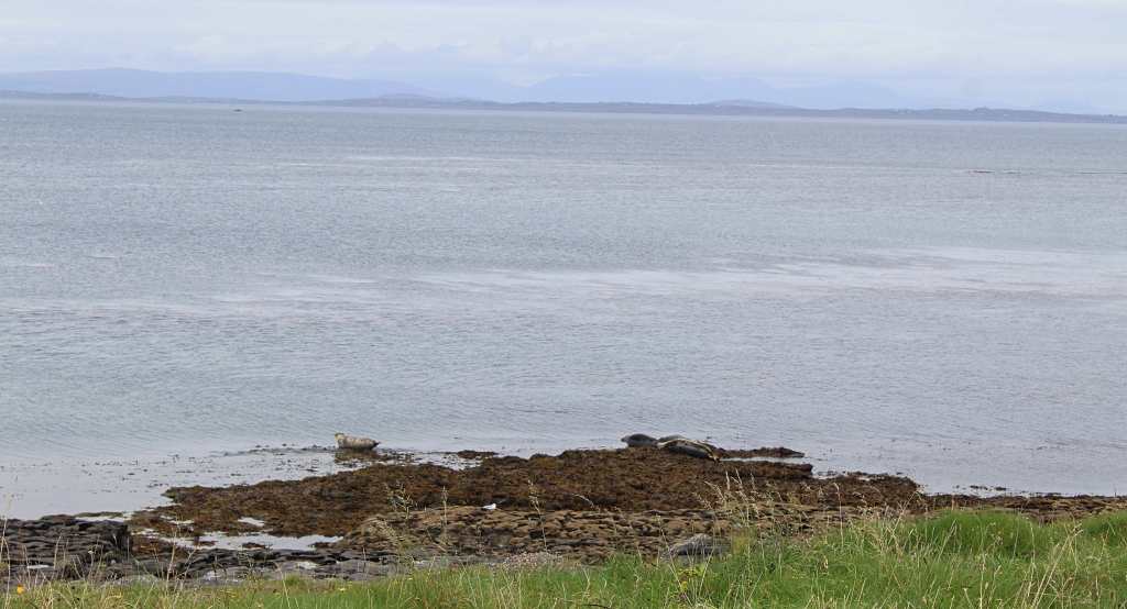
The last attraction on our tour was a small group of seals. Wildlife abounds in West Ireland—its waters home to whales and dolphins, its skies full of sea birds, and its land covered with red deer—and Inishmore is no exception to this rule. A small seal colony shares the island with its human inhabitants, and provides a whimsical sight for the tourists.

Notice the seals.

After around three hours, our guide deposited us back at Cill Rónáin, where we had some good Irish food and a few cold beers. Then, it was time for the ferry ride back to the mainland. That night in Galway, surrounded once again by the hordes of freshers, the island of Inishmore had a sort of dreamlike quality to it—a place trapped in time, preserving a piece of old Ireland so that these young people could one day, too, come to enjoy it. Now that my friend Durso is somewhat older, I’m sure that he would love it even more than he loved Galway.

Near Dublin: Brú na Bóinne & Glendalough

Near Dublin: Brú na Bóinne & Glendalough

This was the moment of truth. I got into the driver’s seat, put on my seatbelt, and gripped the wheel. I had been nervous about this for months: Could I really drive on the “wrong” side?

My panic didn’t seem unwarranted. After all, I am not the most confident driver in a “normal” car, on the right side of the street. Driving in the mirror image world of Ireland struck me as courting death. All of my instincts would be exactly wrong. And Ireland, with its narrow country roads, is not known as the easiest place to drive.

Nervously, cautiously, I rolled the car from its parking spot and onto the road. It was terrifying at first—especially the traffic circles which travel clockwise rather than counter-clockwise—but by the time I got onto the highway, I felt as though I had the hang of it. And not a moment too soon, for we had a guided tour to catch.


Brú na Bóinne

Virtually everyone knows about Stonehenge, those mysterious rocks in the English countryside. But Ireland has her own neolithic ruins, and they deserve to be just as famous.

We parked the car and walked into the cavernous visitor center. There, we were given time to walk through the informative exhibit, which goes through the basics of what we know about this archaeological site.

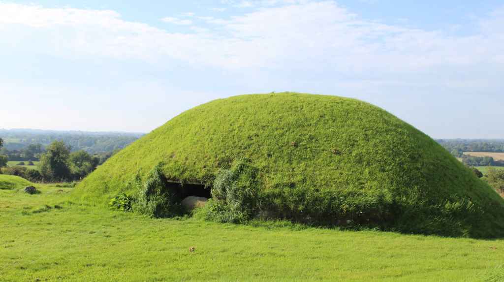
Brú na Bóinne is not a single monument but a whole landscape of ruins. Predating the Great Pyramid by several centuries, it consists of a complex of stone and earth structures, ranging from decorated megaliths to elaborate passage tombs. Like Stonehenge, the site incorporates enormous stones, many of which were transported from far away; and, like Stonehenge, several features of these tombs are aligned with astronomical events, such as the winter solstice. The people who built these tombs were obviously quite sophisticated. 

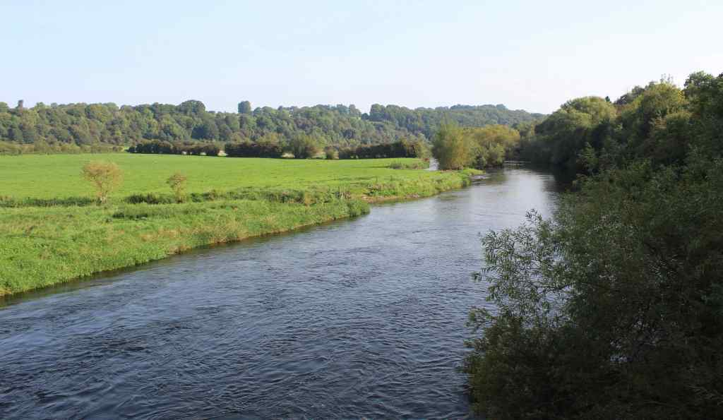
After about half an hour, we were summoned for the real start to the tour. To get to the buses, we had to cross a pedestrian bridge that spans the River Boyne. It was a beautiful day, unseasonably warm for September, and this was our first real glance of the Irish countryside. Although the landscape now must be very different from how it was so many years ago, it was easy to see what attracted the builders of these monuments to this spot. The land was bursting with life.

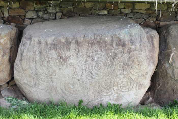
Small buses ferried us the short distance to our first stop, Knowth. This is an assemblage of artificial mounds—piles of earth ringed with decorated stones. These carved kerbstones represent one of the most important collections of prehistoric art in Europe, and they are remarkable indeed. The art is stylized and mostly abstract, consisting of swirling patterns that have been emulated far and wide.

Walking through the site, the visitor is immersed in a whole artificial landscape. The bulbous green mounds are imposing and mysterious. Each one was a tomb. But who were these people? And what did they believe? Whoever they were, they obviously lived in a society with a great degree of sophistication and coordination, as the main passage tomb is a major construction. Two passages were dug into the mound, meeting almost exactly in the middle. More impressive still, these passages were made waterproof. Unfortunately, later intervention (the site was continually used and modified through the years) undid this waterproofing, and the passage tomb can no longer be visited.

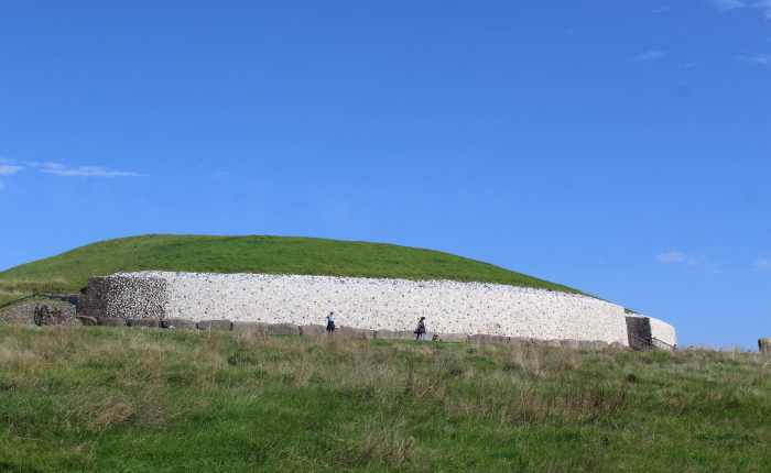
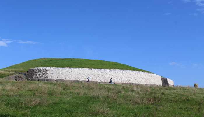
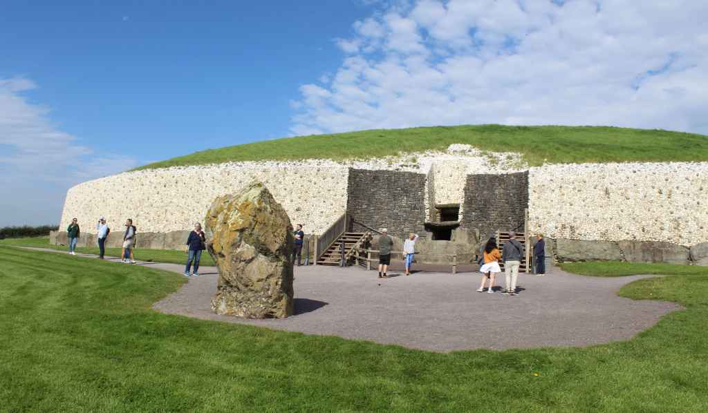
Knowth is a world-class prehistoric site, but Newgrange is the real showstopper. It is another passage tomb, though instead of being ringed by decorated stones, it has a grand, almost ostentatious facade of white quartz. Standing alone on the top of a hill overlooking the river, the tomb looks uncanny, almost otherworldly. I am no believer in ancient aliens, but I can see how these old monuments, which seem to emerge from the landscape, can be unsettling.

Unlike Knowth, the passage of the tomb at Newgrange is still intact, and so visitors can actually go inside. This was mind-boggling to me. No place I had ever visited even remotely compared with the age of this monument. The Colosseum in Rome is nearly 2,000 years old, the Parthenon in Athens is about 500 years older. Newgrange was built over 2,500 years before that. This means that, by the time the Parthenon was constructed, it was about as old to the ancient Greeks as their own monument is to me. 

Compared to these other two monuments, however, it may be difficult for the modern visitor to appreciate the sophistication of Newgrange. A mound of grass is simply less stunning than a huge marble column. But it is not at all easy to build a passage like this one. The stones had to be placed in such a way that they could support their own weight, as well as the considerable weight of all the material on top of them—and, all of it had to be properly waterproofed so that it wouldn’t flood during the first rainstorm. This is quite impressive engineering.

Even to a modern unbeliever like me, there is obvious religious symbolism to the tomb. The walk through the long, dark passageway suggests the path from life to death, and from death to life. This mystical impression is doubly strong when one factors in the “roofbox,” which is the additional opening near the entrance that allows sunlight to enter—but only during a brief moment during the winter solstice.

Since the solstice was still over two months away when we visited, the guide did the next best thing, and activated a light that had been installed near the entrance. First, the overhead lamp dimmed to nothingness, leaving us in darkness. Then, a ray of yellow light creeped through the long passageway until it hit the back of the chamber. Over 5,000 years later, the sight is still awe-inspiring—a testament both to the beauty of the natural world and our own understanding of the cosmos. It would take a heart of stone not to be moved at such a sight. 


Glendalough

The car kept brushing against the side hedges and throwing up pebbles as we hugged the side of the road. My brother was driving; and even though this was after a week of practice, he was still nervous. 

This was a week later, our last day with the rental car. We were on our way back to Dublin to drop it off. But first, we had a last bit of sightseeing to do.

The countryside was, as usual, bucolic. We rolled up and down the green hills, past sheep, tractors, and cottages. At one point, as we rounded a bend, a sign came into view on the hillside above us. It read “Hollywood,” which is exactly where we were: a village in County Wicklow, of about 500 people.

We pressed on. And as we did, the landscape transformed. We were gaining in altitude as we ascended into the Wicklow Mountains. The landscape became rockier, more rugged, and we were treated to an ever-improving sight of the valleys below us.

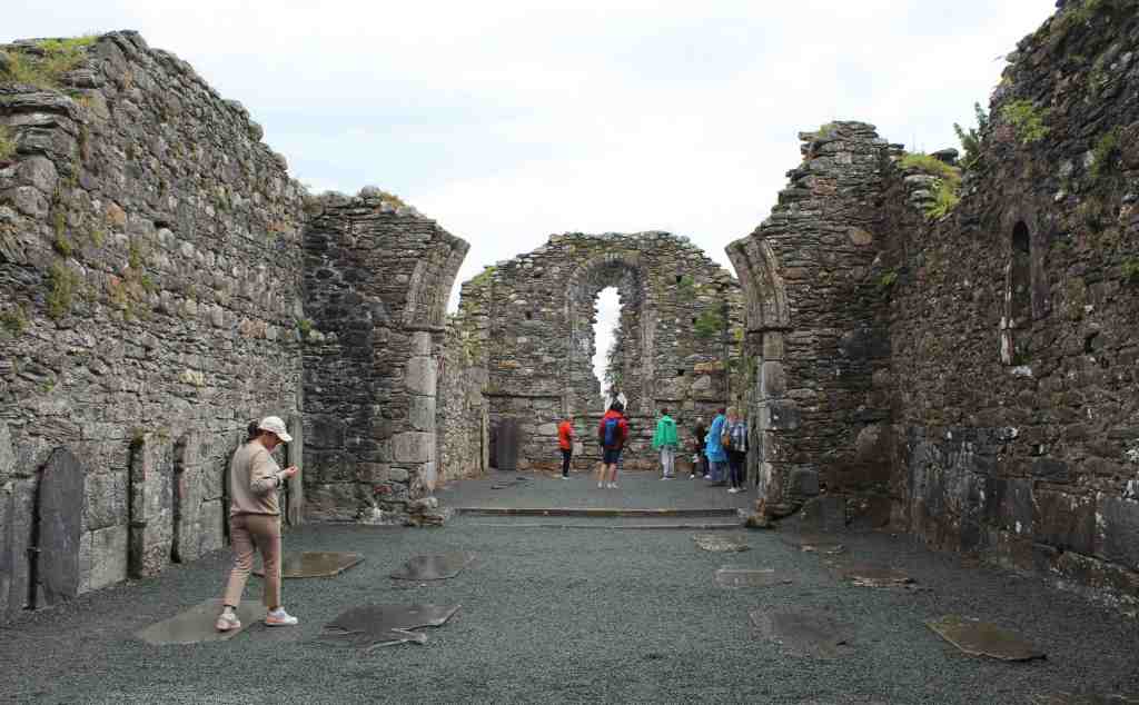
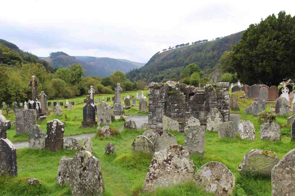
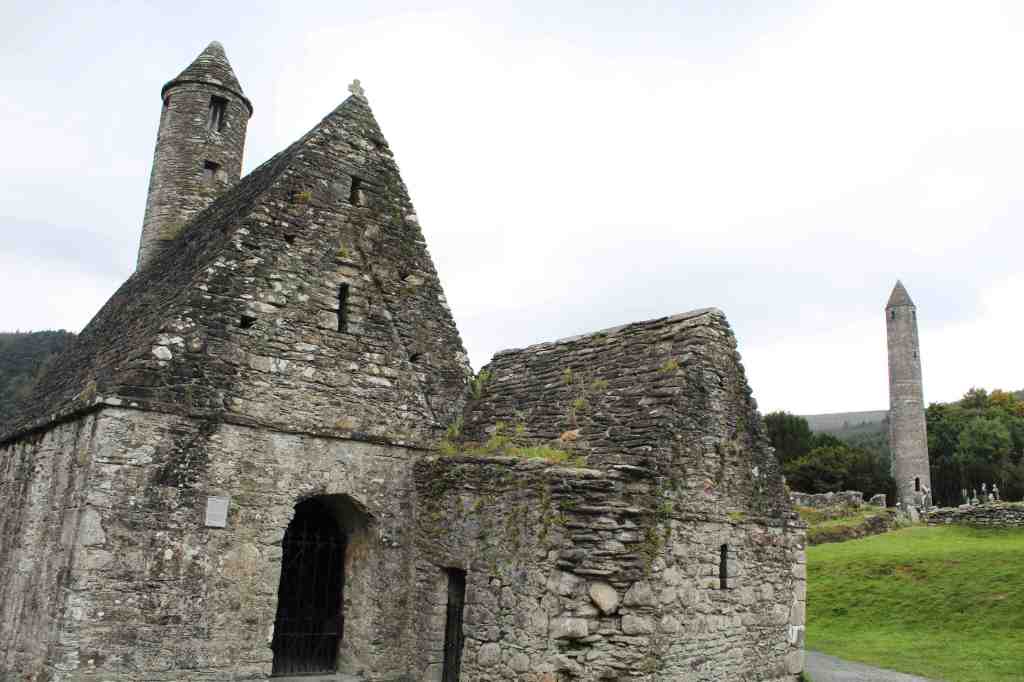
Soon we pulled into our destination: Glendalough. This is one of the loveliest valleys in the mountain range. Carved out thousands of years ago by a glacier, it later became the site of an important monastery, founded by one St. Kevin. Not much can be said for certain about this saint—there are no contemporary sources about his life, and subsequent generations have thoroughly mythologized him—but it is certain that he at least had a good eye for natural beauty, as he chose a gorgeous spot.

The monastery founded by this saint flourished for several hundreds of years after his death, in 618. However, the English—those dependable villains of Irish history—ransacked the place in 1398, burning much of it down. What remains is just a fraction of the original settlement, a haunting collection of graves, walls, and half-destroyed buildings.

The impression of lost time is somewhat lessened, however, by the hoards of tourists who arrive by the busload. Because of its proximity to Dublin, you see, Glendalough is a very popular destination for day-trippers, and the place now has all the trappings of mass-tourism. Parking attendants frantically direct traffic in and out of the many parking lots, while rows of food stands sell burgers and fries to visitors. It is an ironic fate for a place that St. Kevin must have chosen for its peacefulness.

When we visited, conditions were unfortunately not ideal to fully appreciate Glendalough. For one, we were short on time; and the weather was turning dark and stormy. If I’d had more time, I would have loved to do more hiking in the valley, and perhaps visited the Miner’s Village, where workers in the local lead mine used to live. That will have to wait for my next visit.

As it was, after just a couple of hours in Glendalough, we got back into our car and drove the remaining hour to Dublin. Now it was my turn to drive—one last stretch of stress and terror on the roads of Ireland. But fortune was on our side, and we made the journey without a significant mishap. It was with a great sigh of relief that I shut the door of the car and handed the key to the attendant. The crisis had been averted. We had avoided becoming yet another Irish ruin.

Return to Dublin

Return to Dublin

It was odd to be back. My last trip to Dublin, in 2017, was in December. Along with one of my childhood friends and his little brother, we wandered around the city in the cold and dark. We did a lot of walking and a lot of drinking, but not a great deal of sight-seeing. Now, nearly six years later, I was here in early September for a family vacation. The weather was warm, the days long, and I could finally see all the great monuments of Dublin.

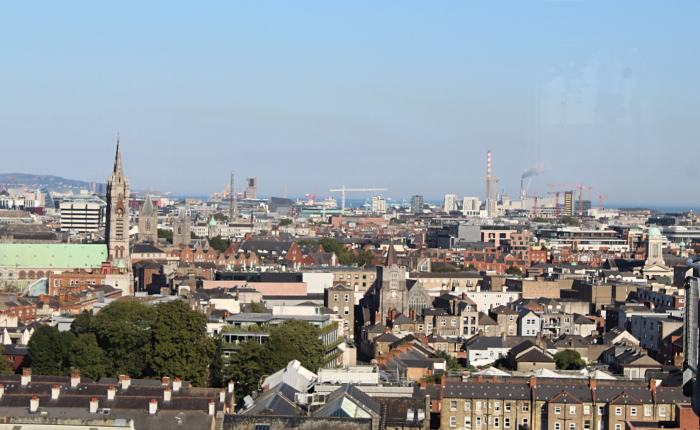
Oriented around the River Liffey, Dublin is far and away the biggest city in the Republic of Ireland. I find it a difficult place to describe. It is dense and populous, yet it has a strange intimacy. One doesn’t feel, as while visiting Paris or New York, lost amid an endless expanse of streets. On the contrary, I felt that I got my bearings rather quickly. And though there are plenty of historical buildings, Dublin also does not feel particularly old. The city is not romantic or particularly beautiful, nor is it cozy and immediately welcoming. Perhaps the best way I can describe it is that it feels like the setting for a tragic-comic play.

Dublin is fairly spread-out for a European city. Its center—if it has one—is the O’Connell Bridge. This bridge is named in honor of the political leader Daniel O’Connell, whose monument is nearby; he was one of the many people who advocated, protested, and fought for Irish autonomy. Within walking distance is the Ha’Penny Bridge and the Temple Bar nightlife district, as well as Trinity College. Standing on this bridge and facing north, you will likely catch sight of the Spire of Dublin, which is exactly what it sounds like. Standing at 120 meters (390 feet) tall, this huge metal spike is not especially beloved by the local population, who have a variety of nicknames for it—such as the “stiffy on the Liffey.”
Wandering southward from the bridge, you will likely come across the statue of Molly Malone. This rather busty woman is carrying her cart of baskets, presumably holding the “cockles and mussels, alive, alive, oh!” of the folk song. Chances are, a street musician will be set up before this statue of Irish musical womanhood, and it may be worth your while to stop and listen. The live music scene in Dublin is one of its great charms. Further south is St. Stephen’s Green, the loveliest park in a city not particularly rich in greenspace. 

I usually prefer using public transportation to get around, though my mom often insisted that we take a taxi. This ended up being a good choice, as the taxi drivers were generally charming and informative. Nevertheless, I did want to pick up a transport card, called a Leap Card. To do this, we went to the General Post Office, on O’Connell Street. This neo-classical structure is something of a national monument, as it was the center of the Easter Rising—a violent revolt against British rule. The building still has bullet holes in its facade to prove it. Nowadays, it is a convenient place to mail letters and get your bus pass.

Yet what I was most excited for was a pair of monuments somewhat outside the city center. After a short bus ride—yes, we had to use those Leap Cards—we found ourselves, somewhat jarringly, standing between a modern office building and an imposing stone structure. (The city is full of juxtaposing old and new.) This fortress-like structure was Kilmainham Gaol, one of the most infamous places in Ireland.

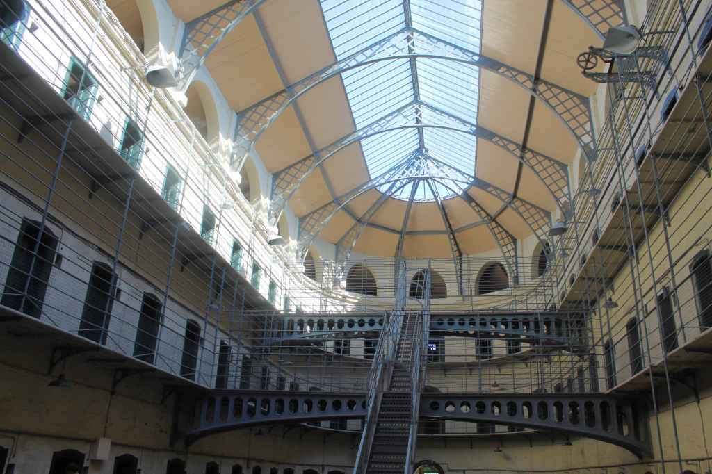
This gaol, or jail, was built in 1796 to replace the medieval dungeon that the city had been using. It was meant to be modern, embodying the “Panopticon” idea of Jeremy Bentham. The idea was to make all of the individual cells visible from a central point, thus subjecting the inmates to constant surveillance. Being under observation, it was hoped, would eventually create self-discipline. Personally, I am doubtful that this really works. In any case, only one part of the prison—the strangely beautiful Main Hall—follows this philosophy. The rest of the prison consists of narrow hallways of cramped cells.

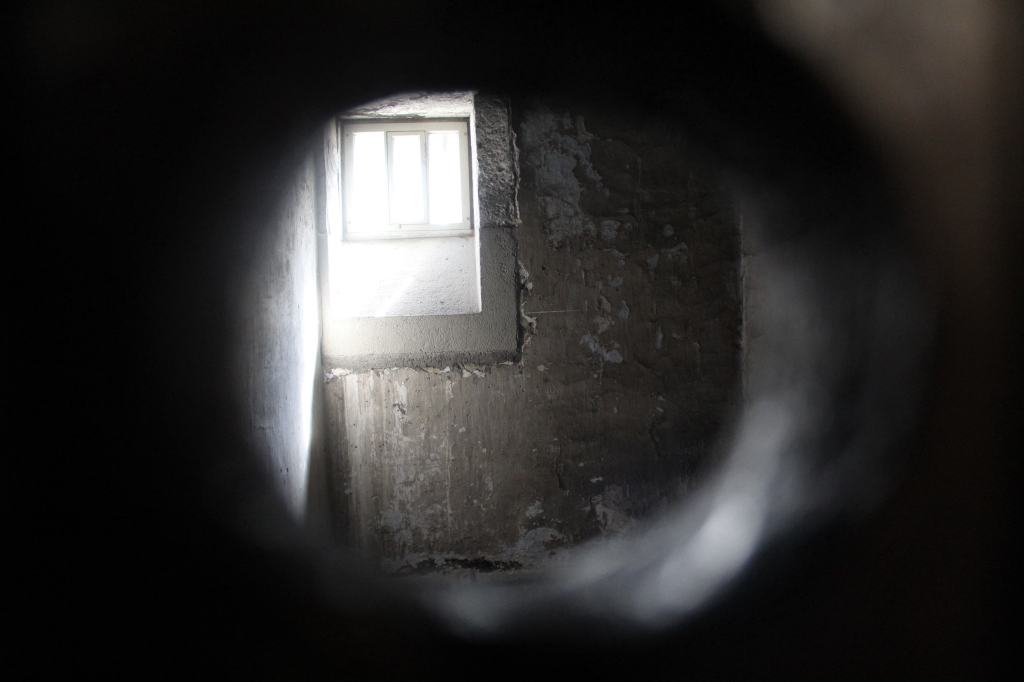
Conditions in the jail were bad. Both men and women were locked up, often on minor charges such as vagrancy or prostitution. Children were even imprisoned here—in one famous case, a child as young as three. Packed like sardines into the cells, the prisoners endured cold, darkness, and hunger. But this is not why the prison became so famous. This was due to its role in the many struggles for independence throughout Ireland’s history. As far back as the 1880s, the great nationalist politician Charles Parnell was imprisoned here (though apparently in quite genteel conditions).

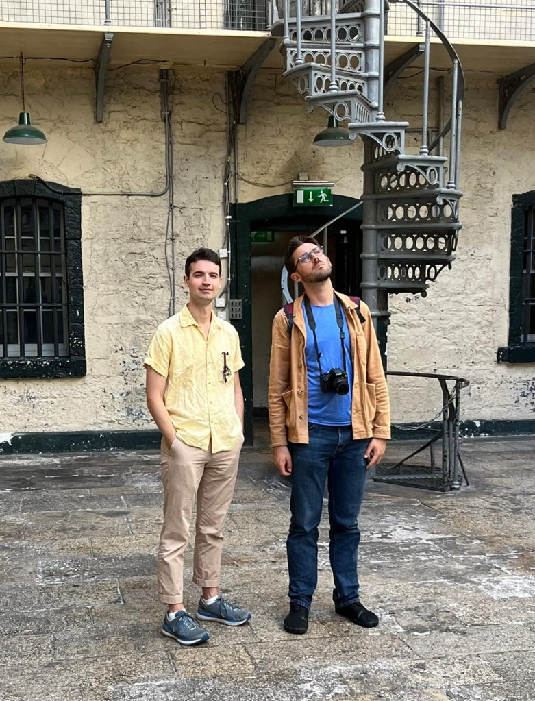
Looking perplexed with my brother.

Parnell escaped with his life. Many others were not so lucky. After the aforementioned Easter Rising of 1916 was crushed, its leaders were taken here, court martialed, and executed. Public sympathy for these figures directly contributed to drafting of the 1918 Declaration of Independence by Sinn Féin. During the War of Independence, many anti-British fighters were imprisoned here; and later, during the Irish Civil War, four IRA prisoners were executed in this jail. In short, Kilmainham Gaol has a grim role in Irish history.

Learning about such things is thirsty work. Thankfully, the Guinness Factory is not too far. Now, I’d visited a few breweries, but this was unlike any I had seen before. The most popular attraction in Dublin—in all of Ireland, in fact—the Guinness Factory is a kind of Disneyland for beer drinkers, not a working factory so much as a theme park. Perhaps a better comparison is an airport, as the visitor winds their way through the exhibits and attractions in the vast space on an endless series of walkways, escalators, and elevators. 

This is making it sound as if I didn’t enjoy the experience. On the contrary, I found it to be well-designed and genuinely fun. Guinness is an institution in Ireland (indeed, the family is now the subject of a Netflix show), whose history goes back to the 18th century, when founder Arthur Guinness famously signed a 9,000-year lease on the property. It was thus a pleasure to learn how the beer and the brand evolved through time.

One of their stranger advertisements.

A few things are noteworthy about the company’s history. For one, Guinness pioneered a groundbreaking welfare scheme for their employees as far back as 1900, at a time when paid retirement was hardly even a dream among the working classes. This is praiseworthy, but the company has also indulged in its share of bigotry. For such a symbol of Irish pride, Guinness has historically been on the side of the Protestant British. Indeed, until as late as 1939 it would fire any employee married to a Catholic; and it would try to avoid employing Catholics until the 1960s.

Nowadays, however, Guinness is, as I said, an institution in Ireland, one of the country’s most iconic symbols. So it was a pleasure to end the tour in the “Gravity Bar,” which is on the very top of the factory building. With a panoramic view of the city of Dublin, it is a very satisfying place to enjoy its most iconic drink: a pint of Guinness. 

Enjoying a Guinness in another establishment.

I should include a little note here about the drink itself. It is often said that Guinness simply tastes better in Ireland. Although I can’t say I drink it enough to verify this, it does seem plausible. This isn’t because of the beer itself, I don’t think. After all, beer travels very well when it is properly bottled and stored. Rather, I think it is because Irish bartenders take a lot of care in pouring it properly. The procedure is always the same: fill it up about three quarters of the way, and let the foam settle for a couple of minutes. Then, the beer is finished with a good fizzy head of foam. By contrast, when I’ve had a Guinness in the U.S. it is either entirely too foamy or has no head whatsoever. And the proper ratio does add a lot to the drinking experience.

The evening was concluded with a visit to the Brazen Head, supposedly Ireland’s oldest pub. This was a repeat experience for me, though my mom greatly enjoyed both the ambience and the food. After that, we were ferried back to our Airbnb by one of the many loquacious cab-drivers in the city, who enthused to us about the nearby Croke Park, a stadium for Gaelic games. The Irish are an independent people, you see, and even their sports are unique.

The next day brought two more repeat experiences: the Book of Kells exhibit in Trinity College Dublin, and the National Archaeology Museum. I highly recommend both.

The Book of Kells is one of the treasures of European art—an intricately decorated copy of the Gospels. It is notable not only for its artistry but for its age: at a time when Europe was at its lowest cultural ebb, friars in remote Ireland were keeping the flame of culture alive. Trinity College is also worth visiting in itself for its historic campus, and especially its stunning old library. When I visited, the artwork Gaia, by Luke Jerram, was on display. This is an inflatable globe, lit from the inside, which looks remarkably like photos taken of the earth from space.

A page of the Book of Kells.
Gaia

The Archaeology Museum is just as impressive. Housed in a stately neo-classical building, it has an amazing collection of objects from Ireland’s long past, from pre-history to the middle ages. This post is no place to delve deeply into the collection (I lack the knowledge for that, anyway), but I do want to mention the lovely gold ornaments from the Bronze Age, the well-preserved dug-out canoe from 2,000 BCE, and of course the famous bog bodies—naturally mummified corpses of men who seem to have been ritually sacrificed. The next time I visit Ireland, I intend to do a lot more preparatory reading about its history.

This was basically it for our initial visit. Luckily, however, we had an extra day back in Dublin before our departure. So I will now fast-forward to the end of our trip.

We dropped off our rental car and checked in to our hotel for the night, which was right above the pub, Darkey Kelly’s. Now, normally I am highly suspicious of hotel restaurants and bars, but this proved to be an excellent choice. This was because of the music. Seated in a circle, about 10 musicians—playing fiddle, accordion, bag-pipe, and guitar—were banging out tune after tune. And they were good. The melodies of these traditional Irish songs are quite fast, intricate, and bouncy, yet these players were perfectly in sync. It was a nostalgic way to end what was an amazing family trip.

The next day, before our hotel check out, we had a bit of time. Thankfully, there was a great museum nearby: the Chester Beatty. This museum is actually housed in a section of Dublin Castle. Despite the name, this is now more of a palace than a castle, though when it was originally built—as far back as 1204—it was a proper fortification. Indeed, Dublin Castle formed the nucleus of what is now Dublin. A body of water in this spot was known as the “dark pool,” whose Celtic translation gave the city its name. The old dubh linn has since disappeared; and the river which fed it, the Poddle, now runs underneath the castle.

The Chester Beatty is named after its founder, Sir Alfred Chester Beatty, who was actually an American. He led an interesting life. Beatty was a sort of Andrew Carnegie type, having made his fortune in the mining business. After a brilliant start to his career, he moved to London, and became ensconced in the upper echelons of that city’s politics and culture. He contributed significantly to the British Museum, and even played a role in the Allied war effort under Churchill. Yet the post-war Labor government seems to have scared off the capitalist American, and he relocated to Ireland in his old age.

Chester Beatty himself.

Thus, it was Dublin, and not London, which inherited his magnificent collection of rare manuscripts. The collection is notable for both its beauty and historic value. Many of the items on display are lovely examples of illuminated manuscripts, from Chinese Buddhist sutras to illustrated Armenian gospels to delicate Islamic calligraphy. And several of the documents on display are enormously rare, such as the Biblical papyri, which are among the oldest surviving versions of the New Testament. The museum would be worth paying a high price to visit. And luckily, it’s free.

We went back to our hotel, packed our things, and headed to the airport—me to fly back to Spain, and my family back to New York. Our trip, so long anticipated, was finally over. And yet I am getting ahead of myself. For this was also just a beginning.

The Madrid Río and the Matadero

The Madrid Río and the Matadero

One of the immediate charms of Madrid is how relatively compact its historic center is. A visitor can easily walk from the Retiro Park, to the Prado, to Gran Vía, and to the Templo de Debod in the course of a day. Explored this way, Madrid is experienced as a series of unfolding streets, plazas, and monuments, winding and criss-crossing their way across a relatively flat landscape. And yet, to get an idea of the contours of the land, of the natural environment that the city inhabits, one must venture further—to the Madrid Río.

This is a park that runs along the Manzanares River. “River” is a generous term for this trickle of water. Originating in the high sierra, the Manzanares runs southward, eventually emptying into the mightier Jarama River. As a natural resource, it is almost negligible—far too shallow for boat travel, and far too scanty to be a significant source of drinking water. But it is this slight river, working over the course of centuries, which carved out the high bluff upon which the Royal Palace is now situated, and which formed the core of the original settlement of Madrid. In other words, it is because of the small valley created by the Manzanares that anyone thought of settling here in the first place.

And the Manzanares has never lost its importance. It makes an appearance in many of Goya’s paintings, as a kind of pleasure ground, where aristocrats dressed as majos and majas took their leisure. During the Spanish Civil War, this humble river formed an important line of defense for the city. And during this century, the Madrid Río was the site of a major project of urban renewal.
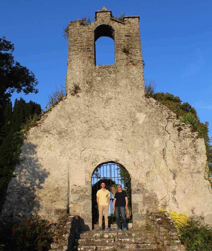
Goya’s “Dance on the Banks of the Manzanares.”

For years, you see, this trickle of water had been sandwiched between the two directions of the M-30, the circular highway that was built in the 1960s to alleviate congestion in the city center. With three lanes of traffic on either side, the Manzanares could no longer be enjoyed by the madrileños.

Yet this changed in the early 2000s, when control of the highway was passed to the local city government, who soon decided to move this section of the highway underground. As you might imagine, this was a massive project, costing several billion euros; and it resulted in the longest network of traffic tunnels in Europe.

But it was worth it—for the burial of the highway solved many urban problems at once. Most obviously, it helped to alleviate some of the noise and pollution of the passing traffic. What’s more, the project re-connected neighborhoods that had been cut in two by the highway, weaving the city together again.

But the most precious result of this project was, I think, the restored access to the Manzanares River. This is no small matter. In a city lacking in any conspicuous natural features, the humble Manzanares is one of the only things that ties the city center to the landscape. And the good citizens not only got their river back, but a wonderful park to boot. Stretching for miles on either side of the river, the Madrid Río Park was created on the surface of the highway tunnels—and it is now one of the treasures of the city.
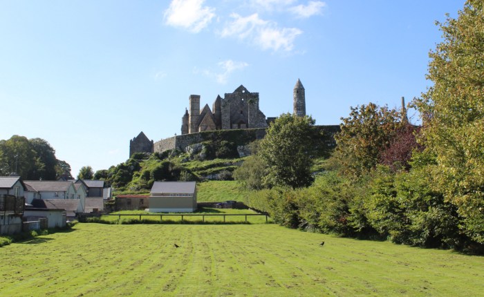
A model of the Madrid Río in the visitor’s center. It shows the (now demolished) Vicente Calderón stadium, which is now part of the park.

For the most part, this park consists of walking, jogging, and biking paths that run parallel to the course of the river. Shade is, admittedly, something of a problem in the hotter months, as the recently-planted trees haven’t had time to grow to their full splendor yet. Still, for such a narrow park, surrounded on both sides by apartment buildings, it can feel remarkably peaceful and quiet. Traffic passes over and under, largely out of view.

The park is notable for the many attractive pedestrian bridges that connect its two sides. There are the two “shell bridges,” near the Matadero, with lovely paintings on the inside. The aptly-named Puente monumental de Arganzuela is an enormous spiral that swirls across the river. A favorite of mine is the Puente del Principado de Andorra, which is a kind of faux-railway bridge, made with crisscrossing iron beams, but which splits apart to form a triangle.

The Puente del Principe de Andorra

The most beautiful, by far, is the Puente de Toledo—a stone bridge built in an ornate Barroque style. It emulates the far older, and more historically significant, Puente de Segovia. Built in the 16th century, this was the first major bridge to span the Manzanares river. It was mentioned frequently by Spain’s Golden-Age poets—though, admittedly, often in a humorous vein, for being so enormous in comparison with the stream it spans. It is a bridge in search of a river, mucho puente para tan poco río.

The Puente de Segovia: Mucho puente para tan poco río.

I want to mention here something puzzling to many visitors. At several points along the river there are what appear to be Greek columns. They look old and weather-beaten, and at first I wondered if they were genuine remains of an old temple. But their placement—much too far apart to belong to a single building—seemed to eliminate that possibility. The truth is that these are not columns at all, but ventilation shafts. You can prove this for yourself if you observe them from above: they are hollow inside.
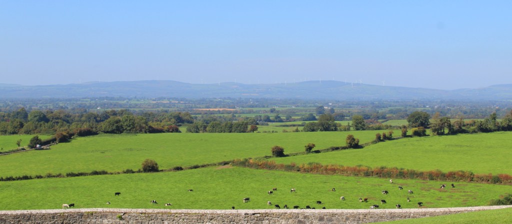
You see, one of the reasons it was originally decided to canalize the river was that it was becoming a hazard for hygiene. As sewage continually drained into the Manzanares, it became an open cesspool. Thus, underground channels were made to divert contaminated groundwater. These channels had to be ventilated, to prevent pressure from building up, and the air shafts were disguised as Greek columns. If you look closely, you will notice that some of them still bear the scars from bullets and shrapnel from the Spanish Civil War. 

Notice the column

Apart from its bridges, the river is also crossed by several dams—seven, to be exact. In the past, these were used to build up the waters of the Manzanares to a respectable level, allowing the citizens to swim and even the local rowing teams to practice. Yet this was not good for the wildlife—trapping fish, and flooding the many habitats adjacent to the river.

A major decision in the creation of the Madrid Río park was the opening of the dams, allowing the river to return to its natural state. This rewilding has created a surprisingly vibrant ecosystem in the sandy banks of the river, where plants and animals thrive. Especially happy are the birds, which have flocked to the area. Now, a visitor can see an astounding variety of species, from nile geese to herons to cormorants. (The rowing team, on the other hand, have been left up the river without a paddle.)

The river in its natural state.

The Madrid Río is also home to some cultural sights. The Ermita de la Vírgen del Puerto (Hermitage of the Virgin of the Harbor) is a rather severe brick building from the early 18th century, where madrileños like to practice salsa dancing. Nearby is the Ermita de San Antonio de la Florida, a church decorated by Francisco de Goya, which also serves as the painter’s tomb. (Across the street is Casa Mingo, a classic restaurant serving roast chicken.) Further down is the Puente de los Franceses, a railroad bridge built by French engineers, which served as an important point in the defense of Madrid by the International Brigades during the Civil War. 

Yet the most significant cultural landmark along the river may be the Matadero. The word matadero is simply Spanish for “slaughterhouse,” and that is exactly what this building complex used to be. In the past, you see, there were commercial livestock pens and slaughterhouses in the city center. But as the city grew, it was decided that this was both inadequate and unhygienic. Thus it was decided to build a large municipal slaughterhouse in what was then the outskirts of the city. After a lengthy planning period, and over a decade of construction, the Madrid Matadero opened in 1925.
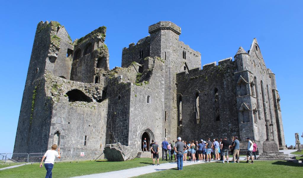
The Matadero is a complex of nearly identical buildings connected by walkways and courtyards. Each building was originally for a different purpose. Some were pens to hold living animals, others were for the act of killing. Some were for cattle, others for pigs, and others for chickens. And of course there were processing facilities, too, where the meat was broken down, divided, salted, preserved, boiled, and so on. One can only imagine the stench.

Much time and care was spent in making this facility both attractive and efficient. Yet the city quickly overtook the scope of the original design. As the Matadero got swallowed up in the expanding urban center, it was no longer isolated from the populace. What is more, a part of it had to be demolished to make way for the aforementioned M-30 highway, further limiting its use. Most of all, however, the facility was simply not big enough, nor modern enough, for the new Madrid. By the 1970s, the Matadero ceased its original function, and nobody was quite sure what to do with it.

Luckily, it was ultimately decided not to demolish these buildings, but to convert them into what they are today: a cultural center. It was an inspired choice, as the architecture of the Matadero is astoundingly lovely. Built in a neo-Mudéjar style—with bricks, stonework, and tiles—the buildings seem almost festive with their pointed roofs. One wonders why such a place was made to look so pretty, as it must have been nauseatingly grim while it served its original function. Now, however, it is positively inviting.
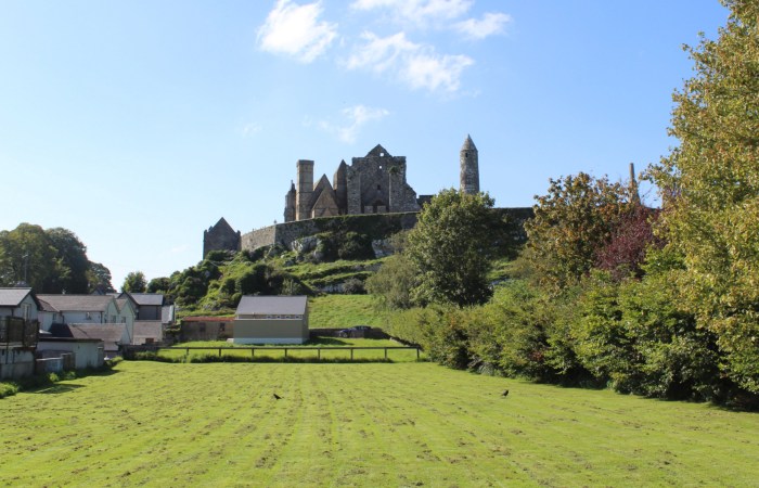
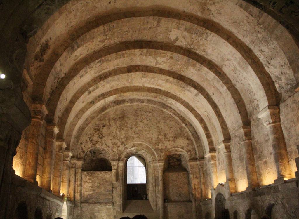
The pigeon wanted to be in the shot.

It is difficult to enumerate all of the things that the visitor can see and do at the Matadero. They have theater performances, both contemporary and classical, both inside and outdoors. There are photography and art exhibits; and the cultural center is the permanent headquarters of the National Dance Company. There is even a small movie theater showing artsy films. Added to this, the Matadero hosts various events throughout the year, from concerts to seasonal markets, from comic book conventions to ice skating rinks and theme park rides. With its bar and café, it is a remarkable resource for the madrileño looking for a bit of culture.

The Matadero café, with its enormous furnace for processing animal remains.

Next to the Matadero is an attractive group of yellow apartment buildings that surround a central courtyard. This is the Colonia del Pico del Pañuelo, built to provide affordable housing for the workers of the Matadero. Its name (“the point of a handkerchief”) comes from its form: from above, it looks like a folded piece of fabric. Made of reinforced concrete, the workers’ colony is nevertheless quite picturesque, and has been featured in several films. Nowadays, however, it is not quite so affordable. 

I also want to mention another nearby attraction, the Crystal Palace of Arganzuela. This is a large greenhouse next to the Matadero. Free to visit, the greenhouse has four separate areas corresponding to different climatic zones. It adds a bit of natural wonder to the cultural attractions next door.

After discussing all of this history, and all of these landmarks, I fear that I am still not doing justice to the real charm of these places. The Madrid Río is, above all, a park—and a good one. Flat and scenic, it is ideal for a lazy bike ride or a long run—or just for sitting on a bench and watching the locals stroll by. There is a football field and a skate park, and several cafés and kiosks where the visitor can have a cold beer under the blue sky. The Matadero is special for being a cultural space that is primarily for the madrileños. One doesn’t have to wait in line with hordes of tourists here—and I hope it stays that way.

And the Madrid Río keeps going. If you follow the river south, you go through the Parque Lineal de Manzanares, an oddly futuristic park, where you can admire Manolo Valdés’ monumental statue of a woman’s head. Go further along the river, and the city is left behind completely. You find yourself in the arid countryside of central Castille, where storks nest in giant colonies and caves perforate the cliffs overhead. This is where I would go on my long runs, savoring the sliver of green that is the river, as it cuts through the yellow landscape. After an hour of running, the city would seem like a distant memory, somehow swallowed up in the shallow waters of the Manzanares.

Difficult Day Trips: Patones de Arriba & Las Cárcavas

Difficult Day Trips: Patones de Arriba & Las Cárcavas

For years I had been beguiled by images of Las Cárcavas—a crazy undulation of land, tucked away in the sierra of Madrid. Photos made the place seem otherworldly; and I was dying to see it for myself. Unfortunately, however, there did not seem to be any good way to get there on public transport. Studying the bus routes and the map, I found that the closest that I could get was a tiny village that I’d visited once before: Patones de Arriba.

So early one Saturday morning, I took the metro to Plaza de Castilla, and caught the 197 bus to a small village called Torrelaguna. From there, I caught the 913 bus—a mini-bus, which followed the winding path up a hill to the old and picturesque village of Patones de Arriba. I was the only passenger on board that day. And by the time I arrived, it was still so early that the streets were virtually empty.

Patones de Arriba (unlike its modern cousin, Patones de Abajo down the hill) is a time capsule of a place. It seems to have survived virtually unchanged since antiquity. Stone huts cover an otherwise barren hillside—the town hidden among the foothills of the sierra, in a place that would be naturally defensible should any dare to attack it. 

The architecture is a prime example of what the Spanish call arquitectura negra: all of the buildings made out of the distinctive black slate of the area, which naturally breaks off into thin plates. This gives the town a striking uniformity—both between its buildings, and with the landscape. The tallest building is the old church, though nowadays it is used for the tourism office. Indeed, I am not sure that anyone actually lives in Patones de Arriba these days—it is a kind of living museum attached to the modern settlement below.

The town is full of relics of its agricultural past. There are stone threshing floors (for separating the wheat from the chaff), pig pens, and cattle sheds. We can also see signs of village life, in the form of ovens, wine cellars, and laundry basins, all made from the local slate. But the real pleasure of visiting the village is simply enjoying the ambience of the past—and, perhaps, a good lunch. On my first visit, years prior, we went into one of the restaurants and had a hearty meal of good Spanish mountain fare—bean stews and red meat.

But by the time I arrived, there was nothing open and, apparently, nobody there. So I walked through the town and then out into the surrounding hills, on my way to Las Cárcavas. 

The countryside here is, like much of the interior of Spain, windswept and bare. In the best of times, the soil and rain could not support luxuriant vegetation; and, in any case, centuries of human habitation have destroyed a large portion of the old forests. The result is that much of Spain, though dramatic in its vistas—the view extending until the horizon—unwinds itself in a patchy surface of rocky ground covered with low shrubs.

The walk was long, winding, and somewhat monotonous—going up and down hill after hill. The only thing to attract the eye were the many pieces of water infrastructure. Large tubes shot out of the hillside, down into valleys and back up again. Further on, stone aqueducts crossed from elevation to elevation. Finally, the explanation for all this came into view: the Pontón de Oliva.

This mammoth construction was the first dam built under the auspices of the Canal de Isabel II, the organization responsible for Madrid’s water supply. And this brings me to a small detour in our hike. Like New York City, you see, Madrid has long struggled to supply its citizenry with clean, safe drinking water. And this is due to the location of both cities: New York is surrounded by brackish, dirty, ocean water, while Madrid has virtually no natural water sources to speak of.

When Madrid was still a relatively small city, local wells and streams were enough to solve this problem. But by 1850, with the city’s population nearing a quarter of a million, the lack of water was becoming a serious issue. The engineers in both NYC and Madrid hit upon the identical solution: dam the rivers in the mountains to the north, and transport the fresh mountain waters to the thirsty city. The Pontón de Oliva was the first step taken in this effort.
It was constructed during the reign of Isabel II, who became the first (and, so far, the only) ruling queen of modern Spain after a succession dispute, which involved a rebellion by her uncle, don Carlos. These wars, called the “Carlist wars,” ended in her victory. This left the new queen with quite a few prisoners of war, whom she put to use building this dam under extremely gruelling conditions. (I tried to look up the number of prisoners who died during the construction, but I couldn’t find it.) To make matters worse, the engineers who designed the dam had chosen a bad location of the river Lozoya, making it all but useless. Today, it stands as a kind of monument of wasted effort—something for hikers and history buffs to appreciate, but dry as a bone.

Just beyond this dam, I finally arrived at my goal: Las Cárcavas. Now, “cárcava” is just the Spanish word for “gully” (though it certainly sounds more attractive); and this one is just a particularly big example of a common phenomenon—namely, water erosion. Though the details are complex, the principle is quite simple: intermittent water flow down steep terrain causes rivulets to form, creating a distinctive undulating pattern as they wear their way through the landscape.

I stood on the lip of this gully and sat down, absolutely exhausted. I had been walking for several hours by then, up and down hills, with no shade from the punishing June sun. Now it was past noon, and the temperature was climbing. I ate my packed lunch (a tuna empanada and a small bottle of gazpacho) as I observed a column of ants make their way through the dusty earth, and amused myself by tossing them little bits of fish. Then, after getting my fill of this alien world, I drained my water bottle and got wearily to my feet.

Water, I have discovered, is a powerful thing. It can move landscapes and determine the destiny of cities. And I found now that I hadn’t brought enough of it. I had well over an hour before I could make my way to civilization, all of it under the merciless Spanish sun. And I was already thirsty. The only choice was to press on. Attempting to distract myself with an audiobook, I walked down the hill, past the dam, and onto a local road.
At just the point when I was risking heat stroke, I arrived in Patones de Abajo and stumbled into the nearest bar. There, I ordered the biggest “clara” they had (beer mixed with lemon soda), and then ordered another one. Then, after another long bus ride back to Madrid, I enjoyed glass after glass of the city’s fine tap water—water that had itself been on a journey from the sierra—which, I found, tasted especially good that day.
From Madrid to the Skies: the Planetarium and the Royal Observatory

From Madrid to the Skies: the Planetarium and the Royal Observatory

“¡De Madrid al cielo!” is something people here like to say—meaning, I suppose, that Madrid is so marvelous that it can only be surpassed by a visit to heaven itself. And Madrid certainly is marvelous, not least for its big open skies, so often completely cloudless. Indeed, there are two institutions in the city dedicated to exploring the air and space above: the Planetarium and the Royal Observatory.
The Planetario de Madrid is a futuristic-looking building located in the south of the city, in the Tierno Galván park. Climbers scale the large concrete wall nearby, and electronic music festivals are often held in the park’s center. Constructed in 1986, the Planetarium gives the impression that it is how the designers imagined houses might look on Mars, in the distant year 2025. 

Underneath the bulbous dome of the planetarium is a semi-circular screen, where educational programs are projected—cartoons for kids, documentaries for adults, and educational sessions for school groups. Through an oversight, I once sat through a film about velociraptors who constructed a space ship and traveled throughout the universe, only to return to earth and find the bones of their ancestors in museums.

The rotating projector used in the semi-spherical dome

Apart from these films, the Planetarium has a small exhibition space, where the visitor can see short educational films on the solar system, gravity, and the history of the universe. There are replicas of Mars rovers and space suits, as well as displays on the Milky Way and the moons of Jupiter. Most beautiful, I think, are the photos of distant galaxies and nebulae, taken by the Hubble Telescope and gently illuminated. The universe is a frighteningly beautiful place. All this being said, I think the exhibit space is rather light, and in general the Planetarium is geared towards younger audiences. Still, it is always worthwhile to contemplate the stars.


The Real Observatorio is certainly not a visit for kids. This royal institution was founded in 1790 by Carlos III, and it bears all the hallmarks of its Enlightenment origins. The Observatory is a kind of temple of science—housed, as it is, in a cathedral-like building designed by the great architect Juan de Villanueva. To visit, you need to reserve a spot on a guided tour, which are only available on weekends (and I believe are only available in Spanish). But if you have any interest in the history of science, the visit is certainly worth the trouble.

The tour begins in the great edifice of Villanueva, which preserves so much confident optimism of the Age of Reason. In the great hall, a Foucault pendulum hangs from the ceiling, making its slow gyrations. This device—the original of which hangs in the Panthéon of Paris—is a demonstration of the rotation of the earth, as the planet’s movement under the pendulum makes it appear to spontaneously change direction.

Distributed around the space were any number of beautiful antique telescopes and other scientific devices—crafted by hand out of polished brass and carved wood. Antique clocks hung on the walls in abundance, as if the scientists of that era had to double- and triple-check the time for their observations. In the main chamber, a large telescope occupied the center of the space. There, mounted like a canon, a metal rod is pointed at the slotted ceiling. Below it, a plush chair with a folding back allowed the scientist to look through it from either side.

But the star attraction of the Observatory is held in a different building, a short walk from the Villanueva edifice. This is the great telescope of William Herschel, the English-German astronomer. This huge contraption was built in an English shipyard in 1802 for the new Royal Observatory. It was to be the center of the whole scientific enterprise. Unfortunately, fate soon intervened in the form of Napoleon, whose troops occupied the Royal Observatory (it has a strategic vantage point on a hill) just a few years later. These soldiers melted down the metal parts of the telescope for munitions and used the wood to keep warm. Thus, the current telescope is a careful reproduction, completed in 2004.

The tour ends in the Hall of Earth and Space sciences, a kind of miniature museum that is run by Spain’s Instituto Geográfico Nacional. The exhibit is divided into four sections: astronomy, geodesy, cartography, and geophysics. Each display is full of yet more scientific instruments, both old and new. There are armillary spheres (for determining the position of the planets in the sky), theodolites (for surveying land), and samples of volcanic eruptions from the Canary Islands. My favorite was a lithographic plate used in the printing of the National Topographic Map—the official, hyper-detailed, super-accurate map of the country.

The Royal Observatory is still an active scientific enterprise, monitoring both the skies above and the earth below—though the amount of light pollution in the city makes even Herschel’s great telescope largely useless. Instead, they receive data from far away telescopes, such as the Gran Telescopio Canarias, located high up in the mountains of La Palma, above the clouds and far from major city centers.

Yet even if Madrid’s skies no longer serve the purposes of science, they still inspire locals and visitors alike. As I write this, I am peering up at the blazing ethereal blue of a mid-September day, with the laser-like sun casting sharp shadows on the street below. It is, indeed, just one step short of heaven.